Thanks to our partner Pasar vzw you get free access to this route – and make your acquaintance with RouteYou PLUS.
Discover all benefitsThe sleepy village of Kemmel is the starting and ending point of a sturdy hike that takes you along the Heuvelland walking junction network, around and over the steep Kemmelberg.
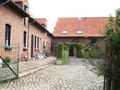
Text and photo Guido Elias
This walk starts at the tourism service/visitor center Het Heuvelland opposite the Sint-Laurentiuskerk of Kemmel. You will discover some nice exhibitions, with particular attention to the war history of Heuvelland from 1914-18. The route along the Heuvelland walking network often goes over quiet farm roads and slow paths. There is quite a bit of climbing to do, and the route takes you over the Kemmelberg, to the rural Dranouter, and back to Kemmel, including via the slopes of the Monteberg. Enjoy the stunning views of Heuvelland and the beautiful, sometimes impressive panoramas along the way. In Dranouter, you can take a break to dine or have a drink. But above all, enjoy this delightful region during your walk, where time seems to have stood still.
The route
Upon leaving the visitor center Heuvelland (V), turn right at Dries – the large square with kiosk – and follow the arrow towards junction 80. This will lead you to the gateway – in the left corner of the square – of the Warand domain, where the municipal services are located in the castle. After junction 80, follow the arrow to 81 through the avenue, you will arrive at De Lork and cross the Bergweg (towards the Kemmel summit) and continue on through the Provincial domain Kemmelberg. It can sometimes be (very) muddy here, and the path climbs considerably. From 81, it goes through the domain to 82 and 83 after which you head towards junction 73 and reach the Kemmel summit (156 m) with the pure white French Monument (1), a remembrance of the Great War. Enjoy the magnificent panorama. Continue along Klokhofweg to 72 and via the lower slopes of the Monteberg (131 m) and Lettingstraat to 65 and then right to 64. Through the Bergstraatje, it now goes to junction 59, located 500 m further. Then to 7 and through Lettingstraat to junction 6 located 1 km further in the center of Dranouter with the Saint John the Baptist Church (2). Here, be extra cautious! Now, head towards junction 10 (100 m from 6) and then take the route towards 11. Therefore, cross the road, turn right, and immediately left in Zwartemolenstraat, and after 500 m, you will arrive at junction 11. To the next two junctions, 20 (via Steenstraat) and then 21, it is each time a 900 m walk. It goes through a vast landscape and extensive fields. Further to 22, 55, and 54, each time a few hundred meters of walking. Via Noordbroekstraat to 25, left to 24, and along Kraeyestraete to 26. Via a path to 91 and further to junction 27. Be careful when crossing the busy Kemmelstraat. Now, a considerable distance to walk to 87 and further to 85 (crossing Kemmelstraat and passing the war cemetery). From 85, it is still about 1 km to junction 80 and the starting point.
Need more walking inspiration? Visit www.pasar.be/wandeltips
Source: Pasar.be
See something wrong on this route?Add an issue
Navigate route in...
![]() RouteYou app Open
RouteYou app Open
![]()
Please wait, your print is being prepared.
Your print is ready to download. Have fun on the road!
Processing your request has failed. Please try again.
<iframe src="https://plugin.routeyou.com/routeviewer/free/?language=en&params.route.id=6974006" width="100%" height="600" frameborder="0" allowfullscreen></iframe>
<p><a class="routeYou_embed" href="https://app.routeyou.com/en-be/route/view/6974006?utm_source=embed&utm_medium=article&utm_campaign=routeshare&navigation=external" title="Kemmelberg Tour - RouteYou" target="_blank"><img src="https://image.routeyou.com/embed/route/960x670/6974006-en@2x.png" style="width: 100%; height: auto;" alt="Kemmelberg Tour"></a></p>
Additional feedback:
This feature is only available to RouteYou PREMIUM subscribers.
Try 1 month for free and discover the difference! We don't take any payment details, and your trial ends automatically after one month.
© 2006-2026 RouteYou - www.routeyou.com