
Lien copié. Collez le lien dans Instagram pour partager l'itinéraire.

Grâce à notre partenaire Pasar vzw, vous pouvez accéder gratuitement à cet itinéraire - et découvrir RouteYou PLUS.
Découvrez tous les avantages
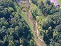
You walk in a rural area between the E19 highway and the residential centers of Waarloos and Kontich. You follow a 3 km walking path through De Oude Spoorwegberm, which is one of the longest and narrowest natural areas in Flanders.
Directions
From the parking, you head north towards the church. However, you don't need to go that far because after the first building, a former dairy now known as Parochiaal Centrum Berkenhof, you turn right. You walk over the parking lot to a chalet. You step along the edge of the soccer field and turn left at the end.
The gravel path makes three turns before the playground and you walk straight to the back of the church. Here, you go right along the hedge and immediately left so that you come out at the front of the church in the street where you started. Go left past the church and take the first street to the right (Kerkelei). Keep following it until you reach the road that connects Antwerp with Mechelen (N1). Go briefly left and then carefully cross that busy road via the median island. Follow the road straight ahead. Where the modern office buildings now stand, the Maes-Pils brewery used to be located. At a T-junction, you go left and shortly after, at the dead-end street, you turn right.
After just 250 m, take the first asphalt road to the left. At the next two splits, it's always to the right.
At the triangular square, you choose left and follow straight the asphalt road next to a rustic villa with a wrought-iron entrance gate.
This narrow asphalt road first runs close to the highway before veering away from it again. You come out on a larger road at the foot of a bridge over the highway. Here, turn right and follow the bike path for 150 m.
At the municipality border Rumst-Kontich, you carefully cross the street and follow the narrow Hondstraat. Not for long, because after just 200 m you must go right along a tiled footpath through the greenery.
You immediately come out onto a street in a residential area. At the first intersection, go left and shortly after at the T, take right. A bit further in the curve is the access avenue to the Tanghof castle, but we continue straight ahead.
At the cobbled intersection (bicycle junction 93), you go left and follow Rijkerooistraat. The asphalt path makes two turns before you reach a split where you go right.
Keep following this path until you come out onto a street and a bridge over the highway.
Follow the street to the right (Keizershoek) for 1.2 km. Before the house with number 99, turn right along a walking and cycling path. The asphalt path quickly turns into cobblestones. Just further, a bridge crosses a drainage ditch. On the other side of the pond is a playground and a nice picnic area. From now on, you follow an old railway embankment, so you must steadily go straight. Along the way, you cross several streets. First, you reach the Reepkenslei, which you cross diagonally to the left. After 250 m, you are back on the busy road (N1).
There, turn briefly right towards the traffic lights to cross the road. Walk straight past the wooden gate. You now follow the GR12 that connects Amsterdam with Paris. You are now fully in the nature area De Oude Spoorwegberm. In total, this is 5 km long and only 20 to 50 m wide, making it one of the longest and narrowest nature reserves in Flanders. In rainy weather, this section can be muddy. After a kilometer, you reach a wooden fence with a gate. Here, cross the street diagonally to the left.
We continue to follow the GR12 a little longer. A wooden owl checks whether you are on the right path, but you can't go wrong, it's always straight ahead. At the next street, you simply cross and follow the sandy path straight past a chalet. A little further, you still have to cross a primitive bridge to avoid getting wet feet.
Not even 200 m beyond that, you again come to a wooden fence with a gate. A little further, you turn right along a large stream. In the distance, you see the church tower of Waarloos.
You keep following the sandy road, turning right over a brick bridge. At the first sandy road on the left, you go straight. You end up in a floodplain. If you go left here, you will arrive at the parking lot where you started. An information board tells you.
Vous avez remarqué quelque chose sur cet itinéraire ?Ajouter rapport
Parcourir l'itinéraire dans...
 Application RouteYou Ouvrez

Veuillez patienter, votre impression est en cours de préparation.
Votre impression est prête à être téléchargée. Bonne route !
Le traitement de la demande a échoué. Veuillez réessayer.
Commentaires supplémentaires :
Cette fonctionnalité est exclusivement disponible pour les abonnés RouteYou PREMIUM.
Essayez 1 mois gratuit maintenant et découvrez la différence ! Nous n'exigeons aucune donnée de paiement et le service s'arrête automatiquement après votre période d'essai d'un mois.
© 2006-2026 RouteYou - www.routeyou.com



 Pasar vzw






 Télécharger


