
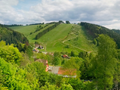
The Höhenweg around Sankt Andreasberg in Lower Saxony offers you a varied hike over 16.5 kilometers. With a moderate difficulty and 431 meters of elevation gain, the route takes you through breathtaking mountain meadows near St. Andreasberg and along the Silberhütte. You will enjoy the unspoiled nature while mostly hiking on unpaved paths that keep you away from cars. The continuous signage makes it easy to follow the loop-shaped route. Let yourself be enchanted by the picturesque landscape and the tranquil watercourses along the way.
¿Has notado algo en esta ruta?Añadir un problema
Navegar ruta en...
 Aplicación RouteYou Abre
¿No quieres ver más este anuncio?
→ Mejorar ahora

Espere, se está preparando la navegación.
Ahora puede navegar. ¡Diviértete en el camino!
El procesamiento de la solicitud ha fracasado. Por favor, inténtelo de nuevo.
¿No quieres ver más este anuncio?
→ Mejorar ahora
Espere, se está preparando su descarga.
Su descarga esta lista. ¡Diviértete en el camino!
El procesamiento de la solicitud ha fracasado. Por favor, inténtelo de nuevo.
¿No quieres ver más este anuncio?
→ Mejorar ahora
Espere, se está preparando su impresión.
Su impresión está lista para descargarse. ¡Diviértete en el camino!
El procesamiento de la solicitud ha fracasado. Por favor, inténtelo de nuevo.
<iframe src="https://plugin.routeyou.com/routeviewer/free/?language=es&params.route.id=4377350&params.language=en" width="100%" height="600" frameborder="0" allowfullscreen></iframe>
<p><a class="routeYou_embed" href="https://app.routeyou.com/en-de/route/view/4377350?utm_source=embed&utm_medium=article&utm_campaign=routeshare&navigation=external" title="Trail around Sankt Andreasberg - RouteYou" target="_blank"><img src="https://image.routeyou.com/embed/route/960x670/4377350-en@2x.png" style="width: 100%; height: auto;" alt="Trail around Sankt Andreasberg"></a></p>
Comentarios adicionales:
Esta función está disponible únicamente para los suscriptores de RouteYou PREMIUM.
Pruébalo gratis durante 1 mes y descubre la diferencia. No pedimos datos de pago y se interrumpe automáticamente tras el periodo de prueba de un mes.
© 2006-2026 RouteYou - www.routeyou.com



 Auf dem Weg in Deutschland






 Comenzar
 Descargar
 Descargar

