Blorenge, also called The Blorenge , is a prominent hill overlooking the valley of the River Usk near Abergavenny, Monmouthshire, southeast Wales. It is situated in the southeastern corner of the Brecon Beacons National Park. The summit plateau reaches a height of 1,841 feet .
Blorenge overlooks the market town of Abergavenny and the villages of Llanfoist and Govilon in the Usk Valley to the north. At the foot of the hill lies the Monmouthshire & Brecon Canal. It drops away steeply to the northwest into Cwm Llanwenarth. To the south, gentler slopes fall away to Blaenavon at the head of the Lwyd valley. Prominent peaks seen from the Blorenge include the Skirrid to the east of Abergavenny and the Sugar Loaf to the north. The high moorland ridge continues to the south of the minor road at Foxhunter car park and assumes the name Mynydd y Garn-fawr. The cairn referenced in the title of this southerly shoulder of Blorenge may be that now known as Carn y Defaid which sits on the county boundary at a height of 503m. It is the most prominent amongst a handful of Bronze Age burial cairns.
Risorsa: Wikipedia.org
Diritti d'autore: Creative Commons 3.0
![]() | | Pubblica
| | Pubblica
Monmouthshire, Regno Unito
Scopri gli itinerari più belli e popolari della zona, accuratamente raggruppati in apposite selezioni.
Risorsa: Jynto (talk)
Diritti d'autore: Creative Commons 3.0
Scopri i luoghi di interesse più belli e popolari della zona, accuratamente raggruppati in apposite selezioni.
Risorsa: Jynto (talk)
Diritti d'autore: Creative Commons 3.0
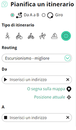
Con RouteYou puoi creare facilmente mappe personalizzate. Traccia il tuo itinerario, aggiungi waypoint o nodi, luoghi di interesse e di ristoro, e condividi le mappe con la tua famiglia e i tuoi amici.
Pianificatore di itinerari

<iframe src="https://plugin.routeyou.com/poiviewer/free/?language=it&params.poi.id=1572835&params.language=en" width="100%" height="600" frameborder="0" allowfullscreen></iframe>
Prova questa funzionalità gratuitamente con un abbonamento di prova RouteYou Plus.
Se hai già un tale account, accedi ora.
© 2006-2024 RouteYou - www.routeyou.com