La Basseille is a stream in the Ardennes in Belgium, a tributary of the western Ourthe that is part of the Meuse basin. It flows entirely within the province of Luxembourg.
Course
The stream rises in Saint-Hubert north of the aerodrome at a place called Thier de la Borne at an altitude of 546 m. It then flows exclusively through the Freyr forest, passes south of Laneuville-au-Bois, and empties into the western Ourthe near the Centre Hospitalier de l'Ardenne de Sainte-Ode at an altitude of 347 m. La Basseille flows for about 10 kilometers. Over a large part of its course, it serves as a boundary between the municipalities of Tenneville and Sainte-Ode, and its banks are classified as a nature reserve.
Translated from French
Source: fr.wikipedia.org
 | | Pública | Alemany • Danès • Espanyol • Francès • Italià • Neerlandès

Seleccioneu una de les activitats més populars a continuació o perfeccioneu la cerca.
Descobriu les rutes més boniques i conegudes de la zona, acuradament agrupades en seleccions adequades.
Seleccioneu una de les categories més populars a continuació o inspira't en les nostres seleccions.
Descobriu els llocs d'interès més bonics i coneguts de la zona, acuradament agrupats en seleccions adequades.
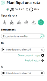
Amb RouteYou pots crear mapes personalitzats molt fàcilment. Defineix la teva ruta, afegeix waypoints o interseccions, planifica parades a punts d'interès o a establiments per menjar i beure i comparteix-ho tot amb els amics i la família.
Planificador de rutes
<iframe src="https://plugin.routeyou.com/poiviewer/free/?language=ca&params.poi.id=8566530&params.language=en" width="100%" height="600" frameborder="0" allowfullscreen></iframe>

Més de 11.800.000 rutes

Més de 15.000.000 usuaris

Més de 4.500.000 llocs d'interès

Kerkstraat 108
9050 Gentbrugge, Bèlgica
© 2006-2026 RouteYou - www.routeyou.com



