

Gràcies al nostre soci Gemeente Kortenberg, pots accedir gratuïtament de franc a aquesta ruta I familiaritzar-te amb RouteYou PLUS.
Descobreix-ne tots els avantatges
The Keizerdelle hike owes its name to the Keizerdelle, one of the field complexes between Steenokkerzeel, Berg, Nederokkerzeel, and Peperstraat in Erps-Kwerps. It is commonly referred to as Kasdel. The name Keizerdelle or the valley of the De Keyzer family, who were likely the owners of these fields.
Before we start the hike, we can walk around the church and view a few interesting buildings.
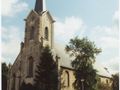
We leave from the Sint Amandus church in Erps. We cross the village square and walk into Kammestraat. 200 m further on the left side, we see the Kam or brewery of Jan van Ransem. About 250 m after the intersection with Dreef, we turn right into footpath 63, which connects Kammestraat with Frans Mombaersstraat. There we turn left and walk almost to Mechelsesteenweg.
Before we reach the roundabout, we see on our right side the chapel of the Christ Child of Prague. There we turn right into neighbor path 11, which is commonly referred to as the way to Vosseputten. This path runs alongside the chapel and becomes a nice sunken path. This path first crosses the continuation of Curegemstraat, then Vosseputten, where we notice some chalets. 200 m further, we turn right into footpath 10, which leads into Keizerdellestraat.
If we are already tired here, we can continue to Peperstraat. If we turn left there, we quickly reach the village square from which we started.
If we are still fit, we turn left into footpath 66, which leads to Dorenbaan. At Dorenbaan stands the chapel of Sint Rochus. We turn left into neighbor path 4, where we take a sharp right after almost 900 m into neighbor path 6 or Lindekensweg. This path merges into Nederokkerzeelsesteenweg directly opposite Kasteelstraat. We turn right and see the chapel of the Sacred Heart of Jesus opposite Oudebaan. A little further down Peperstraat is the Van Hammehuis.
At the old town hall of Erps-Kwerps, we reach the village square again from which we started.
Has vist alguna cosa en aquesta ruta?Afegir un problema
Navega per la ruta a...
 Aplicació RouteYou Obriu

Espereu, s'està preparant la teva impressió.
La teva impressió està llesta per descarregar. Diverteix-te a la carretera!
Processament de la sol·licitud ha fracassat. Si us plau, torneu a intentar.
<iframe src="https://plugin.routeyou.com/routeviewer/free/?language=ca&params.route.id=169959&params.language=en" width="100%" height="600" frameborder="0" allowfullscreen></iframe>
<p><a class="routeYou_embed" href="https://app.routeyou.com/en-be/route/view/169959?utm_source=embed&utm_medium=article&utm_campaign=routeshare&navigation=external" title="Keizerdelle hike - RouteYou" target="_blank"><img src="https://image.routeyou.com/embed/route/960x670/169959-en@2x.png" style="width: 100%; height: auto;" alt="Keizerdelle hike"></a></p>
Feedback adicional:
Aquesta funció està disponible únicament per als subscriptors de RouteYou PREMIUM.
Prova-ho gratuïtament durant 1 mes i descobreix la diferència. No demanem dades de pagament i es desactiva automàticament després del període de prova d'un mes.
© 2006-2026 RouteYou - www.routeyou.com



 Gemeente Kortenberg






 Descarregar


