
Enllaç copiat. Enganxeu l'enllaç a Instagram per compartir la ruta.

 Azure
AzureMain road: 167 km
The GR 564 is varied and contrasted. Dunes and low bogs, sand and water, heathland and forests. Wet meadows, fruit and corn plantations, large square farms and small villages with pointed church steeples. In Hespengouw, you are always surprised by wide views. You cross the language border and plunge into the Mehaigne valley with ups and downs, castles and old villages.
In the first part of your visit you will discover the sandy hills of the Limburg Kempen. Through forests and nature reserves, along marshes and ponds, the road heads south. First through the nature reserves Terhaagdoornheide and De Teut, a little further along the areas of Kelchterhoef and Hengelhoef to reach Bokrijk. In Diepenbeek you cross the Albert Canal.
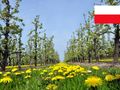
Then the landscape changes. You first cross the wet valley of Demer and Kortessem, you cross the Limburg Haspengouw. You pass through a rich region with larger farms, square clogs, cereals and beets and more and more fruit plantations, which display theirflowersin spring. Borgloon was the historic capital of Loon County and calls itself the "Pearl of Haspengouw" and it shows. Here and there you are surprised between the views by a pointed church tower of an old village center sometimes almost sleepy. After Landen, you cross the language border and arrive for the first time in the region that, several centuries ago, was the central area of the Merovingian courtiers.
In the last part, the landscape changes little at first. You will stay in Haspengouw for a while, with old villages and wide views. You cross Hannut and Avennes, where you reach the Mehaigne valley. Now you will go up and down: wet valleys with forests and swamps, fields on the heights and here and there an imposing castle. Your tour ends in Huy on the banks of the Meuse River and at the border of Condroz, where the route connects to the GR 576.
Has vist alguna cosa en aquesta ruta?Afegir un problema
Navega per la ruta a...
 Aplicació RouteYou Obriu
Deixar de veure aquest anunci?
→ Millorar ara

Espereu, s'està preparant la navegació.
Ara pots navegar. Diverteix-te a la carretera!
Processament de la sol·licitud ha fracassat. Si us plau, torneu a intentar.
Deixar de veure aquest anunci?
→ Millorar ara
Espereu, s'està preparant la teva descàrrega.
La teva descàrrega està llesta. Diverteix-te a la carretera!
Processament de la sol·licitud ha fracassat. Si us plau, torneu a intentar.
Deixar de veure aquest anunci?
→ Millorar ara
Espereu, s'està preparant la teva impressió.
La teva impressió està llesta per descarregar. Diverteix-te a la carretera!
Processament de la sol·licitud ha fracassat. Si us plau, torneu a intentar.
Feedback adicional:
Aquesta funció està disponible únicament per als subscriptors de RouteYou PREMIUM.
Prova-ho gratuïtament durant 1 mes i descobreix la diferència. No demanem dades de pagament i es desactiva automàticament després del període de prova d'un mes.
© 2006-2026 RouteYou - www.routeyou.com



 Grote Routepaden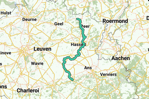






 Començar
 Descarregar
 Descarregar

