Kallern is first mentioned around 1303-08 as Kaltherren. During the Late Middle Ages, the major landowners in Kallern were Muri Abbey and Hilfikon. After 1415, the village belonged to Muri. Then, after 1435 it belonged to the district of Boswil in the Freie Ämter. Under the Helvetic Republic it was part of the Canton of Baden. Kallern, Ober- and Unterhöll and Uezwil formed a collective community. Niesenberg was connected to Bettwil. The Act of Mediation in 1803 led to the current community. In 1962, a chapel was built in Oberniesenberg, and in 1975 a school and multipurpose room were finished. In 1969, electric street lights came to the village and in 1970, a central water supply was added. In 1980 Hinterbühl was developed as a residential area, and in 1984 it was connected to the sewage treatment plant at Bünzen. In 2000 a quarter of the economically active population worked in agriculture and two thirds were commuters. At the beginning of the 21st Century Kallern possessed neither public transportation or shops.
Kallern has an area, as of 2009, of 2.68 square kilometers . Of this area, 2.08 km2 or 77.6% is used for agricultural purposes, while 0.36 km2 or 13.4% is forested. Of the rest of the land, 0.25 km2 or 9.3% is settled .
Font: Wikipedia.org
Drets d'autor: Creative Commons 3.0
![]() | | Pública | Alemany • Espanyol • Italià • Neerlandès
| | Pública | Alemany • Espanyol • Italià • Neerlandès
Kallern, Muri, Suïssa
Descobriu les rutes més boniques i conegudes de la zona, acuradament agrupades en seleccions adequades.
Font: DidiWeidmann
Drets d'autor: Creative Commons 3.0
Descobriu els llocs d'interès més bonics i coneguts de la zona, acuradament agrupats en seleccions adequades.
Font: DidiWeidmann
Drets d'autor: Creative Commons 3.0
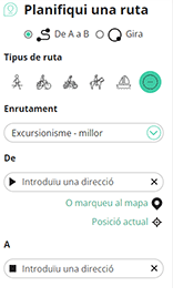
Amb RouteYou pots crear mapes personalitzats molt fàcilment. Defineix la teva ruta, afegeix waypoints o interseccions, planifica parades a punts d'interès o a establiments per menjar i beure i comparteix-ho tot amb els amics i la família.
Planificador de rutes

<iframe src="https://plugin.routeyou.com/poiviewer/free/?language=ca&params.poi.id=1615302&params.language=en" width="100%" height="600" frameborder="0" allowfullscreen></iframe>
Proveu aquesta funcionalitat gratuïtament amb una subscripció de prova RouteYou Plus.
Si ja disposa d'aquest compte, connecteu ara.
© 2006-2024 RouteYou - www.routeyou.com