

Pfofeld lies in the West Middle Franconia region, about five kilometres east of Gunzenhausen. In the north of the municipality are parts of the Großer Brombachsee and its forebay, the Kleiner Brombachsee, as well as the Altmühlüberleiter channel. In Roman times the limes ran through the area. The European watershed runs through the municipality and divides the catchments of the Rhine and Danube. A stream, the Dornhauser Mühlbach flows through Pfofeld; other local streams include the Bachwiesengraben, the Buxbach and the Brombach. The municipality is characterised by low hills and woods, including the Weißenberg and the Gräfensteinberg Forest. Staatsstraße 2222 runs past Pfofeld to the north. Within the municipality are the nature reserves of Brombachmoor and Halbinsel im Kleinen Brombachsee.
Font: Wikipedia.org
Drets d'autor: Creative Commons 3.0
 | | Pública | Alemany • Danès • Espanyol • Francès • Italià • Neerlandès

Seleccioneu una de les activitats més populars a continuació o perfeccioneu la cerca.
Descobriu les rutes més boniques i conegudes de la zona, acuradament agrupades en seleccions adequades.
Font: HaSe
Drets d'autor: Creative Commons CC BY-SA 4.0
Seleccioneu una de les categories més populars a continuació o inspira't en les nostres seleccions.
Descobriu els llocs d'interès més bonics i coneguts de la zona, acuradament agrupats en seleccions adequades.
Font: HaSe
Drets d'autor: Creative Commons CC BY-SA 4.0
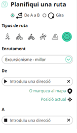
Amb RouteYou pots crear mapes personalitzats molt fàcilment. Defineix la teva ruta, afegeix waypoints o interseccions, planifica parades a punts d'interès o a establiments per menjar i beure i comparteix-ho tot amb els amics i la família.
Planificador de rutes
<iframe src="https://plugin.routeyou.com/poiviewer/free/?language=ca&params.poi.id=8076771&params.language=en" width="100%" height="600" frameborder="0" allowfullscreen></iframe>

Més de 11.800.000 rutes

Més de 15.000.000 usuaris

Més de 4.500.000 llocs d'interès

Kerkstraat 108
9050 Gentbrugge, Bèlgica
© 2006-2026 RouteYou - www.routeyou.com



