Font: Photo: Wikipedia


King Alfred's Tower stands near the location of 'Egbert's stone' where it is believed that Alfred the Great, King of Wessex, rallied the Saxons in May 878 before the important Battle of Ethandun, where the Danish army, led by Guthrum the Old was defeated.
The project to build the tower was conceived in 1762 by the banker Henry Hoare II (1705-1785). The tower was also intended to commemorate the end of the Seven Years' War against France and the accession of King George III.
The tower was designed in 1765 by Henry Flitcroft, the notable 18th century Palladian architect, and despite the inspiration from St. Mark's Tower in Venice, this tower is rather different. Building began in 1769 or early 1770, and was completed in 1772 at an estimated cost of between £5,000 and £6,000. In April 1770, when the tower was just 4.7 metres (15 ft) high, Hoare is quoted as saying: 'I hope it will be finished in as happy Times to this Isle as Alfred finished his Life of Glory in then I shall depart in peace.
The tower is 49 metres (161 ft) high, and is triangular in plan, with round projections at each of the three corners. One of these, furthest from the entrance door, has a spiral staircase within it by which visitors can climb the 205 steps to the top, where there is a platform with a crenellated parapet. The staircase is not well illuminated, with only ten small openings to admit a little daylight. The centre of the tower is hollow and open to the elements; in recent years a mesh has been placed over the opening at the top to prevent birds from entering the tower. The total girth of the tower is approximately 51 metres (167 ft), which means that the tower's circumference and height are about the same. From the top you may see as far as Hinkley Point power station (about 50 miles (80 km) away) on a clear day.
 | | Pública

Seleccioneu una de les activitats més populars a continuació o perfeccioneu la cerca.
Descobriu les rutes més boniques i conegudes de la zona, acuradament agrupades en seleccions adequades.
Font: Photo: Wikipedia
Seleccioneu una de les categories més populars a continuació o inspira't en les nostres seleccions.
Descobriu els llocs d'interès més bonics i coneguts de la zona, acuradament agrupats en seleccions adequades.
Font: Photo: Wikipedia
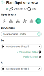
Amb RouteYou pots crear mapes personalitzats molt fàcilment. Defineix la teva ruta, afegeix waypoints o interseccions, planifica parades a punts d'interès o a establiments per menjar i beure i comparteix-ho tot amb els amics i la família.
Planificador de rutes
<iframe src="https://plugin.routeyou.com/poiviewer/free/?language=ca&params.poi.id=713232&params.language=en" width="100%" height="600" frameborder="0" allowfullscreen></iframe>

Més de 11.800.000 rutes

Més de 15.000.000 usuaris

Més de 4.500.000 llocs d'interès

Kerkstraat 108
9050 Gentbrugge, Bèlgica
© 2006-2026 RouteYou - www.routeyou.com