Font: Rieno ✅ Routes
The Utrechtse Heuvelrug is a moraine that was formed in the penultimate ice age (238 to 126 thousand years ago). In this ice age, the Saalian period, the land ice sheet was located from Scandinavia to the ridge. The thick ice sheet had enormous power to carve out deep cavities (up to 100 meters deep). The sand from these cavities then pushed the ice sheet in front of it. In this way, high ridges could form in the landscape halfway through the Netherlands. As it warmed up, the ice sheet melted and the water found its way through the weak spots in the moraine. The water carved deep valleys in the subsurface, creating the icemelt water valleys on the south side of the ridge. A good example of this is the Darthuizerpoort northwest of Leersum.
The Utrechtse Heuvelrug has a multitude of landscape forms, such as beautiful forests, heaths, fens, shifting sands and floodplains. The highest point is the Amerongse Berg, 69.2 meters above sea level. In October 2003 it was officially granted the status of National Park. Through the National Park, the owners (Municipalities, Staatsbosbeheer, Het Utrechts Landschap, Natuurmonumenten and a number of private owners) strive to protect and improve nature, recreation and cultural-historical values. Until 2013, the northern border of the National Park was formed by the A12. In that year, it was extended to the A28.
Font: wikipedia
![]() | | Pública | Neerlandès
| | Pública | Neerlandès
Descobriu les rutes més boniques i conegudes de la zona, acuradament agrupades en seleccions adequades.
Font: Rieno ✅ Routes
Descobriu els llocs d'interès més bonics i coneguts de la zona, acuradament agrupats en seleccions adequades.
Font: Rieno ✅ Routes
Amb RouteYou pots crear mapes personalitzats molt fàcilment. Defineix la teva ruta, afegeix waypoints o interseccions, planifica parades a punts d'interès o a establiments per menjar i beure i comparteix-ho tot amb els amics i la família.
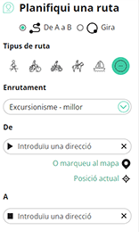
Planificador de rutes

<iframe src="https://plugin.routeyou.com/poiviewer/free/?language=ca&params.poi.id=7453033&params.language=en" width="100%" height="600" frameborder="0" allowfullscreen></iframe>
Proveu aquesta funcionalitat gratuïtament amb una subscripció de prova RouteYou Plus.
Si ja disposa d'aquest compte, connecteu ara.
© 2006-2024 RouteYou - www.routeyou.com