The area of Middag Humsterland was once a sea with the salt marsh islands Humsterland and Middag. The islands were bordered by tidal channels that brought seawater inland during high tide. These incursions occurred from the western Lauwers Sea, now the Lauwersmeer, after it was reclaimed in 1969. The coastline used to reach the city of Groningen, but due to sedimentation in this area, the sea clay area became dry. This process was intensified after 1100 due to the continuous activity of reclamation.
 | | Pública | Alemany • Danès • Espanyol • Francès • Italià • Neerlandès

Seleccioneu una de les activitats més populars a continuació o perfeccioneu la cerca.
Descobriu les rutes més boniques i conegudes de la zona, acuradament agrupades en seleccions adequades.
Seleccioneu una de les categories més populars a continuació o inspira't en les nostres seleccions.
Descobriu els llocs d'interès més bonics i coneguts de la zona, acuradament agrupats en seleccions adequades.
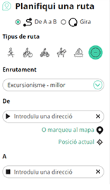
Amb RouteYou pots crear mapes personalitzats molt fàcilment. Defineix la teva ruta, afegeix waypoints o interseccions, planifica parades a punts d'interès o a establiments per menjar i beure i comparteix-ho tot amb els amics i la família.
Planificador de rutes
<iframe src="https://plugin.routeyou.com/poiviewer/free/?language=ca&params.poi.id=576275&params.language=en" width="100%" height="600" frameborder="0" allowfullscreen></iframe>

Més de 11.800.000 rutes

Més de 15.000.000 usuaris

Més de 4.500.000 llocs d'interès

Kerkstraat 108
9050 Gentbrugge, Bèlgica
© 2006-2026 RouteYou - www.routeyou.com



