
Font: FrDr
Drets d'autor: Creative Commons 4.0
The Eikenberg is a hill and road in the municipality of Maarkedal, in the Belgian province of East Flanders. With an 82 m altitude top, it is one of many hill formations in the Flemish Ardennes, in the south of East Flanders.The slopes of the hill are paved in cobbles, with a road gradually winding upwards from the Maarke brook to the top in Kerzelare village, 3 km east of Oudenaarde. The top of the climb is on the intercity road between Brakel and Oudenaarde. The cobbled climb is one of the regular sites in Flemish cycling races in springtime. In 1995 the road of the Eikenberg was classified as a protected monument.
Font: Wikipedia.org
Drets d'autor: Creative Commons 3.0
![]() | | Pública | Català • Francès • Neerlandès
| | Pública | Català • Francès • Neerlandès
Maarkedal,Maarke-Kerkem, Oost-Vlaanderen, Bèlgica

Seleccioneu una de les activitats més populars a continuació o perfeccioneu la cerca.
Descobriu les rutes més boniques i conegudes de la zona, acuradament agrupades en seleccions adequades.
Font: FrDr
Drets d'autor: Creative Commons 4.0
Seleccioneu una de les categories més populars a continuació o inspira't en les nostres seleccions.
Descobriu els llocs d'interès més bonics i coneguts de la zona, acuradament agrupats en seleccions adequades.
Font: FrDr
Drets d'autor: Creative Commons 4.0
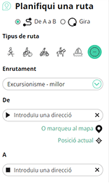
Amb RouteYou pots crear mapes personalitzats molt fàcilment. Defineix la teva ruta, afegeix waypoints o interseccions, planifica parades a punts d'interès o a establiments per menjar i beure i comparteix-ho tot amb els amics i la família.
Planificador de rutes

<iframe src="https://plugin.routeyou.com/poiviewer/free/?language=ca&params.poi.id=1674030&params.language=en" width="100%" height="600" frameborder="0" allowfullscreen></iframe>
Proveu aquesta funcionalitat gratuïtament amb una subscripció de prova RouteYou Plus.
Si ja disposa d'aquest compte, connecteu ara.
© 2006-2024 RouteYou - www.routeyou.com