
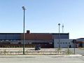
We start at Egemstraat by the sports hall of Pittem. We follow Egemstraat until we reach Kokerstraat, which we enter on the left. In front of us, we see the old Plaatsmolen, and as we continue, we see on the left side the old Cross of Goethals. This cross has been here since 1855.
Along number one of Oostwijk, we take Wielewaalstraat. A few hundred meters further, we follow this road to the right, passing 'Goed Ter Ooigem' on the left. This farm – along the former Ooigemstraat – is first mentioned in 1678 as "behuysde ende bewalde hofstede." This fief was a sub-fief of Claerhout. Among its owners was Jan de la Kethulle (1361-1433), "secretary of my supposed lord of Burgundy." We continue along Wielewaalstraat (formerly Tieltse Binnenweg), and at one of the next bends, we pass an old farm. The ancestors of Guido Gezelle and Stijn Streuvels lived on this farm. Gezelle's great-grandmother was born on this farm (Danneels).
Until the early 1960s, when Jozef Vercoutere left the farm, it was the same family that inhabited the farm. Jan Danneels was the first resident of this family line (early 18th century). A few hundred meters further, we turn right, passing the Zwartegatbeek, which is surrounded by pollard willows, and reach Puttensdreef. After about two hundred meters, we see on the right along this road the farm "Ter Deven or Cappals," where the first trace was discovered as early as 1514. We turn left into Puttensdreef – unfortunately a "Dreef" without trees – until we reach the border with Tielt. Here we have a certain view of the Ronceval forest. In the forest, the Mulle de Terscheuren family built a castle around 1885. However, the castle is definitely located on Pittem's territory. We continue on the footpath and arrive at Bergstraat. We walk until the "top" of the "mountain," 42 meters above sea level.
Until 1814, the "Villakapel" stood here. This chapel was located at the summit of the mountain. It was built in the first half of the 18th century by the Spanish nobleman Jan Baptist de Villa de Castillo, lord of Vlienderbeke, or by his son Louis Charles de Villa, who lived at Suickmote. Here we have a clear view of the surrounding region on clear days and can recognize many towers of neighboring municipalities and parishes.
Now we walk downhill directly towards the estate "Ter Vlienderbeke," which was mentioned for the first time around 1400. The lord of Vlienderbeke was the previously mentioned Jan Baptist de Villa. He was a captain in the Spanish army and lived in 1683 on the 'Gut ter Vlienderbeke.' Vlienderbeke was also a fief and lordship (1362) and was a sub-fief of Claerhout.
In the meantime, we have arrived at Vijfstraat, which we walk a few meters to the right and then leave immediately. We thus head towards 'Goed Ter Gracht,' with the oldest dating from 1470. The name of this road was formerly 'Gentsemeersweg.'
We go straight ahead to an old chapel. A legend tells that the plague approached Pittem in 'ancient times.' When this chapel was hastily built here, the dreaded disease also halted here.
Along the narrow path, we walk in Muizebekeweg over the bridge of Muizebeek towards the village center. We then follow Fonteinestraat and return via the Broeders Maristen park along Kauwstraat back over the market. Through Egemstraat, we end up again at the sports hall of Pittem.
Has vist alguna cosa en aquesta ruta?Afegir un problema
Navega per la ruta a...
 Aplicació RouteYou Obriu
Deixar de veure aquest anunci?
→ Millorar ara

Espereu, s'està preparant la navegació.
Ara pots navegar. Diverteix-te a la carretera!
Processament de la sol·licitud ha fracassat. Si us plau, torneu a intentar.
Deixar de veure aquest anunci?
→ Millorar ara
Espereu, s'està preparant la teva descàrrega.
La teva descàrrega està llesta. Diverteix-te a la carretera!
Processament de la sol·licitud ha fracassat. Si us plau, torneu a intentar.
Deixar de veure aquest anunci?
→ Millorar ara
Espereu, s'està preparant la teva impressió.
La teva impressió està llesta per descarregar. Diverteix-te a la carretera!
Processament de la sol·licitud ha fracassat. Si us plau, torneu a intentar.
<iframe src="https://plugin.routeyou.com/routeviewer/free/?language=ca&params.route.id=13432&params.language=en" width="100%" height="600" frameborder="0" allowfullscreen></iframe>
<p><a class="routeYou_embed" href="https://app.routeyou.com/en-be/route/view/13432?utm_source=embed&utm_medium=article&utm_campaign=routeshare&navigation=external" title="Berghoekweg - RouteYou" target="_blank"><img src="https://image.routeyou.com/embed/route/960x670/13432-en@2x.png" style="width: 100%; height: auto;" alt="Berghoekweg"></a></p>
Feedback adicional:
Aquesta funció està disponible únicament per als subscriptors de RouteYou PREMIUM.
Prova-ho gratuïtament durant 1 mes i descobreix la diferència. No demanem dades de pagament i es desactiva automàticament després del període de prova d'un mes.
© 2006-2026 RouteYou - www.routeyou.com



 Pittem






 Començar
 Descarregar
 Descarregar

