The Giesel is a roughly 10 km long left tributary of the Fulda, which originates in the district of Giesel at 409 m NN. Its primary upper course, also named Gresel, drains, together with its left tributary Saurode and its right tributary, also named Giesel, approximately the eastern half of the Giesel Forest, a large contiguous forest area covering 4,259.6 ha in the eastern part of the Lower Vogelsberg and west of the Fulda depression. It flows into the Fulda in the northern part of the Fulda district of Bronnzell, north and not far from the 215 m long sandstone bridge Kohlhäuser Brücke with over 10 arches at Kohlhaus. The longitudinal profile of the Giesel from its source to its confluence with the Fulda shows a height difference of 156 m.
Font: Wikipedia.org
Drets d'autor: Creative Commons 3.0
 | | Pública | Alemany • Danès • Espanyol • Francès • Italià • Neerlandès
Direcció: Fulda, Alemanya
Estadístiques
Seleccioneu una de les activitats més populars a continuació o perfeccioneu la cerca.
Descobriu les rutes més boniques i conegudes de la zona, acuradament agrupades en seleccions adequades.
Seleccioneu una de les categories més populars a continuació o inspira't en les nostres seleccions.
Descobriu els llocs d'interès més bonics i coneguts de la zona, acuradament agrupats en seleccions adequades.
Amb RouteYou pots crear mapes personalitzats molt fàcilment. Defineix la teva ruta, afegeix waypoints o interseccions, planifica parades a punts d'interès o a establiments per menjar i beure i comparteix-ho tot amb els amics i la família.
Planificador de rutes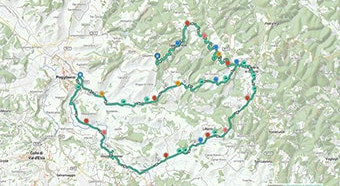
<iframe src="https://plugin.routeyou.com/poiviewer/free/?language=ca&params.poi.id=1381387&params.language=en" width="100%" height="600" frameborder="0" allowfullscreen></iframe>

Més de 11.800.000 rutes

Més de 15.000.000 usuaris

Més de 4.500.000 llocs d'interès

Kerkstraat 108
9050 Gentbrugge, Bèlgica
© 2006-2026 RouteYou - www.routeyou.com