

Haría is a municipality on the island of Lanzarote in the Canary Islands, the northernmost and easternmost Canarian municipality. Surrounded on three sides by the Atlantic Ocean, the municipality is bordered to the south by the municipality of Teguise. It forms part of Las Palmas Province. The seat of the municipality is the town of Haría. The population of the municipality was 4,872 in 2013. The total land area of the municipality is 106.59 square kilometres .
The west of the municipality is largely mountainous, with much of the western coastline rising steeply a little way inland. Numerous miradors on this high ground offer views of the island, with the most well known being the Mirador del Río which is a popular tourist attraction. To the southeast the land is low-lying and largely used for agriculture, with many small beach resorts along the coast. The northeast of the municipality is largely uninhabited, having been buried approximately 3000 years ago by the eruption of the Montaña Corona which formed the inhospitable Malpais de la Corona. This eruption also produced extensive hollow lava tunnels called jameos, some of which have been developed into two of the island's most-visited geological attractions: the Cueva de los Verdes and the Jameos del Agua.
Font: Wikipedia.org
Drets d'autor: Creative Commons 3.0
 | | Pública | Alemany • Català • Espanyol • Francès • Italià • Neerlandès
Direcció: Haría, Espanya
Estadístiques
Seleccioneu una de les activitats més populars a continuació o perfeccioneu la cerca.
Descobriu les rutes més boniques i conegudes de la zona, acuradament agrupades en seleccions adequades.
Font: Max Hermus de Wikipedia en neerlandés
Drets d'autor: Creative Commons 3.0
Seleccioneu una de les categories més populars a continuació o inspira't en les nostres seleccions.
Descobriu els llocs d'interès més bonics i coneguts de la zona, acuradament agrupats en seleccions adequades.
Font: Max Hermus de Wikipedia en neerlandés
Drets d'autor: Creative Commons 3.0
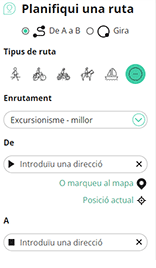
Amb RouteYou pots crear mapes personalitzats molt fàcilment. Defineix la teva ruta, afegeix waypoints o interseccions, planifica parades a punts d'interès o a establiments per menjar i beure i comparteix-ho tot amb els amics i la família.
Planificador de rutes
<iframe src="https://plugin.routeyou.com/poiviewer/free/?language=ca&params.poi.id=1562256&params.language=en" width="100%" height="600" frameborder="0" allowfullscreen></iframe>

Més de 11.800.000 rutes

Més de 15.000.000 usuaris

Més de 4.500.000 llocs d'interès

Kerkstraat 108
9050 Gentbrugge, Bèlgica
© 2006-2026 RouteYou - www.routeyou.com



