Drets d'autor: All rights reserved


Nouart is a rural municipality. It is indeed part of the municipalities that are sparsely or very sparsely populated, according to the density grid of the Insee. The municipality is also outside the attraction of cities. The land use of the municipality, as derived from the European database on biophysical land use Corine Land Cover, is characterized by the importance of agricultural areas, with a proportion roughly equivalent to that of 1990. The detailed distribution in 2018 is as follows: meadows, cropland, forests, heterogeneous agricultural areas, urbanized zones, and areas with shrub and/or herbaceous vegetation.
Font: Wikipedia.org
Drets d'autor: Creative Commons 3.0
 | | Pública | Alemany • Català • Espanyol • Francès • Italià • Neerlandès
Direcció: Nouart, Champagne-Ardenne, França
Estadístiques
Seleccioneu una de les activitats més populars a continuació o perfeccioneu la cerca.
Descobriu les rutes més boniques i conegudes de la zona, acuradament agrupades en seleccions adequades.
Drets d'autor: All rights reserved
Seleccioneu una de les categories més populars a continuació o inspira't en les nostres seleccions.
Descobriu els llocs d'interès més bonics i coneguts de la zona, acuradament agrupats en seleccions adequades.
Drets d'autor: All rights reserved
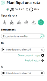
Amb RouteYou pots crear mapes personalitzats molt fàcilment. Defineix la teva ruta, afegeix waypoints o interseccions, planifica parades a punts d'interès o a establiments per menjar i beure i comparteix-ho tot amb els amics i la família.
Planificador de rutes
<iframe src="https://plugin.routeyou.com/poiviewer/free/?language=ca&params.poi.id=1287635&params.language=en" width="100%" height="600" frameborder="0" allowfullscreen></iframe>

Més de 11.800.000 rutes

Més de 15.000.000 usuaris

Més de 4.500.000 llocs d'interès

Kerkstraat 108
9050 Gentbrugge, Bèlgica
© 2006-2026 RouteYou - www.routeyou.com



