

Autry is located some 50 km east of Reims and 25 km north by north-west of Sainte-Menehould. The southern border of the commune is the departmental boundary between Ardennes and Marne. Access to the commune is by road D21 from Challerange in the north-west which passes through the centre of the commune and the village and continues to Binarville in the south-east after changing to the D63 at the departmental border. The D218 goes west from the village to Bouconville and the D41 goes north-east to Lançon. Apart from the village there is the hamlet of La Gare in the west. Large areas of the commune are forested, especially in the west, and there is a large fish farm in the east. The rest of the commune is farmland.
Font: Wikipedia.org
Drets d'autor: Creative Commons 3.0
 | | Pública | Alemany • Català • Danès • Espanyol • Francès • Italià • Neerlandès
Direcció: Autry, Champagne-Ardenne, França
Estadístiques
Seleccioneu una de les activitats més populars a continuació o perfeccioneu la cerca.
Descobriu les rutes més boniques i conegudes de la zona, acuradament agrupades en seleccions adequades.
Font: François GOGLINS
Drets d'autor: Creative Commons CC BY-SA 3.0
Seleccioneu una de les categories més populars a continuació o inspira't en les nostres seleccions.
Descobriu els llocs d'interès més bonics i coneguts de la zona, acuradament agrupats en seleccions adequades.
Font: François GOGLINS
Drets d'autor: Creative Commons CC BY-SA 3.0
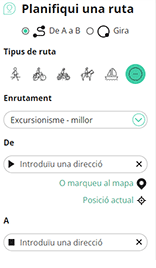
Amb RouteYou pots crear mapes personalitzats molt fàcilment. Defineix la teva ruta, afegeix waypoints o interseccions, planifica parades a punts d'interès o a establiments per menjar i beure i comparteix-ho tot amb els amics i la família.
Planificador de rutes
<iframe src="https://plugin.routeyou.com/poiviewer/free/?language=ca&params.poi.id=1333251&params.language=en" width="100%" height="600" frameborder="0" allowfullscreen></iframe>

Més de 11.800.000 rutes

Més de 15.000.000 usuaris

Més de 4.500.000 llocs d'interès

Kerkstraat 108
9050 Gentbrugge, Bèlgica
© 2006-2026 RouteYou - www.routeyou.com



