

Thoiras is a French commune located in the center of the Gard department in the Occitanie region. Exposed to a Mediterranean climate, it is drained by the Gard, the Gardon de Saint-Jean, the Salindrenque, the Boisseson stream, and various other small bodies of water. Included in the Cévennes, the commune has remarkable natural heritage: two Natura 2000 sites and three areas of ecological, faunal, and floral interest.
Font: Wikipedia.org
Drets d'autor: Creative Commons 3.0
 | | Pública | Alemany • Espanyol • Francès • Italià • Neerlandès
Direcció: Thoiras, Languedoc-Roussillon, França
Estadístiques
Seleccioneu una de les activitats més populars a continuació o perfeccioneu la cerca.
Descobriu les rutes més boniques i conegudes de la zona, acuradament agrupades en seleccions adequades.
Font: Roland45
Drets d'autor: Creative Commons CC BY-SA 4.0
Seleccioneu una de les categories més populars a continuació o inspira't en les nostres seleccions.
Descobriu els llocs d'interès més bonics i coneguts de la zona, acuradament agrupats en seleccions adequades.
Font: Roland45
Drets d'autor: Creative Commons CC BY-SA 4.0
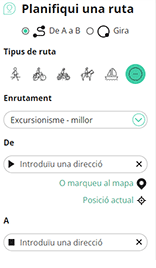
Amb RouteYou pots crear mapes personalitzats molt fàcilment. Defineix la teva ruta, afegeix waypoints o interseccions, planifica parades a punts d'interès o a establiments per menjar i beure i comparteix-ho tot amb els amics i la família.
Planificador de rutes
<iframe src="https://plugin.routeyou.com/poiviewer/free/?language=ca&params.poi.id=1324138&params.language=en" width="100%" height="600" frameborder="0" allowfullscreen></iframe>

Més de 11.800.000 rutes

Més de 15.000.000 usuaris

Més de 4.500.000 llocs d'interès

Kerkstraat 108
9050 Gentbrugge, Bèlgica
© 2006-2026 RouteYou - www.routeyou.com



