
Font: Alexander P Kapp
Drets d'autor: Creative Commons 2.0
Lorton, a parish in the district of Allerdale of the English county of Cumbria, consists of two adjacent villages: Low Lorton and High Lorton. Both nestle at the northern end of the Vale of Lorton, surrounded by fells such as Grasmoor, Hopegill Head and Whiteside. They are about 4 miles from Cockermouth, which gives access to the main A66 road. Other nearby places include Loweswater and Brigham.
Font: Wikipedia.org
Drets d'autor: Creative Commons 3.0
![]() | | Pública | Alemany • Italià • Neerlandès
| | Pública | Alemany • Italià • Neerlandès
Lorton, Allerdale, Regne Unit

Seleccioneu una de les activitats més populars a continuació o perfeccioneu la cerca.
Descobriu les rutes més boniques i conegudes de la zona, acuradament agrupades en seleccions adequades.
Font: Alexander P Kapp
Drets d'autor: Creative Commons 2.0
Seleccioneu una de les categories més populars a continuació o inspira't en les nostres seleccions.
Descobriu els llocs d'interès més bonics i coneguts de la zona, acuradament agrupats en seleccions adequades.
Font: Alexander P Kapp
Drets d'autor: Creative Commons 2.0
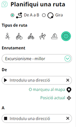
Amb RouteYou pots crear mapes personalitzats molt fàcilment. Defineix la teva ruta, afegeix waypoints o interseccions, planifica parades a punts d'interès o a establiments per menjar i beure i comparteix-ho tot amb els amics i la família.
Planificador de rutes

<iframe src="https://plugin.routeyou.com/poiviewer/free/?language=ca&params.poi.id=1580856&params.language=en" width="100%" height="600" frameborder="0" allowfullscreen></iframe>
Proveu aquesta funcionalitat gratuïtament amb una subscripció de prova RouteYou Plus.
Si ja disposa d'aquest compte, connecteu ara.
© 2006-2024 RouteYou - www.routeyou.com