

Charlwood is a village and civil parish in the Mole Valley district of Surrey, England. It is immediately northwest of London Gatwick Airport in West Sussex, close west of Horley and north of Crawley. The historic county boundary between Surrey and Sussex ran to the south of Gatwick Airport. Boundaries were reformed in 1974 so that the county boundary between Surrey and West Sussex, delineated by the Sussex Border Path, now runs along the northern perimeter of the airport, and the southern extent of Charlwood.
A narrow ridge of Sussex Marble runs through the west of the parish, where it is followed for a distance by the Sussex Border Path. Elevations range from 60 to 140m above sea level. No dual carriageways bisect the area and London Gatwick Airport has its perimeter immediately to the south-west.
Font: Wikipedia.org
Drets d'autor: Creative Commons 3.0
 | | Pública | Alemany • Danès • Espanyol • Francès • Italià • Neerlandès
Direcció: Charlwood, Mole Valley, Regne Unit
Estadístiques
Seleccioneu una de les activitats més populars a continuació o perfeccioneu la cerca.
Descobriu les rutes més boniques i conegudes de la zona, acuradament agrupades en seleccions adequades.
Font: P1ane
Drets d'autor: Creative Commons CC BY-SA 4.0
Seleccioneu una de les categories més populars a continuació o inspira't en les nostres seleccions.
Descobriu els llocs d'interès més bonics i coneguts de la zona, acuradament agrupats en seleccions adequades.
Font: P1ane
Drets d'autor: Creative Commons CC BY-SA 4.0
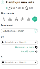
Amb RouteYou pots crear mapes personalitzats molt fàcilment. Defineix la teva ruta, afegeix waypoints o interseccions, planifica parades a punts d'interès o a establiments per menjar i beure i comparteix-ho tot amb els amics i la família.
Planificador de rutes
<iframe src="https://plugin.routeyou.com/poiviewer/free/?language=ca&params.poi.id=1514933&params.language=en" width="100%" height="600" frameborder="0" allowfullscreen></iframe>

Més de 11.800.000 rutes

Més de 15.000.000 usuaris

Més de 4.500.000 llocs d'interès

Kerkstraat 108
9050 Gentbrugge, Bèlgica
© 2006-2026 RouteYou - www.routeyou.com



