
Flemish Mountains Route, Stage 18-N: from Ingooigem to Wortegem
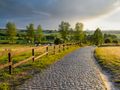
This stage of the Flemish Mountains Route (North) takes you over the northern slope of the Flemish Ardennes: a hilly landscape with a number of peaks, from where you can repeatedly enjoy beautiful views over the actual Flemish Ardennes ridge. You pass the Lijsternest of Stijn Streuvels, cross over the Tiegemberg, traverse villages on the Scheldehang like Kaster and Gijzelbrechtegem, and end in Wortegem.
RATING
Unpaved 5/10
Solitude 6/10
Car-free 6/10
Open space 6/10
Comfort 9/10
Scenery 7/10
INFO
• Ingooigem to Gijzelbrechtegem: www.toerisme-leiestreek.be
• Gijzelbrechtegem to Wortegem: www.wortegem-petegem.be/toerisme-en-vrije-tijd
---
THE FLEMISH MOUNTAINS ROUTE, 600 KM HIKING FROM CALAIS TO COLOGNE
As many peaks as possible, as much unpaved as possible, as much car-free as possible... this is the Flemish Mountains Route in a nutshell. This long-distance hike for lovers of great nature and overwhelming panoramas visits all the peaks of the Flemish hilly country. It will be approximately 600 km long and comprise about 50 daily stages of 15 to 20 km. The Flemish Mountains Route leads over the green hills of Artesian, through the French and West Flemish Heuvelland, over the Flemish Ardennes, through the Pajottenland and the Zoniën region, the Hageland, the Limburg mining area, the Kempen Plateau, Voeren, and the southern Limburg hilly land, the Three Nations Point, and the mighty Hertogenwald.
The Flemish Mountains Route is not signposted but will be published step by step at:
* Route You: per stage. You can find them collected in the group Flemish Mountains Route. You can find the first stage here.
* Plot-a-Route: all completed stages of the Flemish Mountains Route can be downloaded from this page.
THE FLANDERS MOUNTAINS ROUTE, 600 KM HIKING FROM CALAIS TO COLOGNE
As many peaks as possible, as much unpaved as possible, as much car-free as possible... this is the Flemish Mountain Route in a nutshell. This long-distance hike for lovers of great nature and overwhelming panoramas visits all the "peaks" of the Flemish hilly landscape. It will be approximately 600 km long and consist of about 50 daily sections of 15 to 20 km. The Flemish Mountain Route leads over the green hills of Artesian, through the French and West Flemish Heuvelland, over the Flemish Ardennes, through the Pajottenland and the Zoniën region, the Hageland, the Limburg mining area, the Kempen Plateau, Voeren, and the southern Limburg hilly land, the Three Nations Point, and the mighty Hertogenwald.
The Flemish Mountain Route is not signposted but will be published step by step at:
* Route You: per section. You can find them collected in the group Flemish Mountains Route. You can find the first section here.
* Plot-a-Route: all completed sections of the Flemish Mountain Route can be downloaded from this page.
DISCLAIMER
This route has been compiled with the utmost care and runs as far as the author knows exclusively over public roads or private roads with permission. However, users remain responsible for their use of the roads. The author is not responsible for any violations or other problems caused by users of this route. Furthermore, the disclaimer on www.routeyou.com/nl-be/user/view/112095/wanderlust remains fully valid here.
The author is not responsible for injuries, deaths, or breaches of peace that may arise from engaging in the outdoor activities described on these pages. You engage in outdoor activities at your own risk.
COPYRIGHT & CONTACT
This route is the intellectual property of the author. It may only be used for personal use but may not be reproduced for other purposes without the author's consent.
Contact: wanderlust@outlook.be and www.facebook.com/wanderlust.be.
Har du lagt mærke til noget på denne rute?Tilføj et problem
Naviger ruten med...
 RouteYou app Åbn
Vil du ikke se denne annonce mere?
→ Opgrader nu

Et øjeblik, navigationen forberedes.
Du kan nu navigere. God fornøjelse på vejen!
Behandlingen af anmodningen mislykkedes. Prøv venligst igen.
Vil du ikke se denne annonce mere?
→ Opgrader nu
Et øjeblik, din download forberedes.
Din download er klar. God fornøjelse på farten!
Behandlingen af anmodningen mislykkedes. Prøv venligst igen.
Vil du ikke se denne annonce mere?
→ Opgrader nu
Et øjeblik, din udskrift forberedes.
Din udskrift er klar til download. God fornøjelse på farten!
Behandlingen af anmodningen mislykkedes. Prøv venligst igen.
<iframe src="https://plugin.routeyou.com/routeviewer/free/?language=da&params.route.id=4340349&params.language=en" width="100%" height="600" frameborder="0" allowfullscreen></iframe>
<p><a class="routeYou_embed" href="https://app.routeyou.com/en-be/route/view/4340349?utm_source=embed&utm_medium=article&utm_campaign=routeshare&navigation=external" title="Flemish Hills Route, Stage 18-N: from Ingooigem to Wortegem - RouteYou" target="_blank"><img src="https://image.routeyou.com/embed/route/960x670/4340349-en@2x.png" style="width: 100%; height: auto;" alt="Flemish Hills Route, Stage 18-N: from Ingooigem to Wortegem"></a></p>
Yderligere feedback:
Du skal mindst have en RouteYou PREMIUM-konto for at kunne bruge denne funktion.
Prøv nu 1 måned gratis og oplev forskellen! Vi beder ikke om betalingsoplysninger, og det stopper automatisk efter din prøveperiode på en måned.
© 2006-2026 RouteYou - www.routeyou.com



 Paul Maes





 Start
Start Download
 Download

