78 Aufrufe | Öffentlich | Deutsch • Dänisch • Französisch • Italienisch • Niederländisch • Spanisch
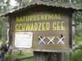
This circular walk in Nauders offers fabulous views of the surrounding landscape. Here, between the Reschen Pass and the Swiss border, lie the peaks of the Kleiner Mutzkopf and Großer Mutzkopf – and between them two beautiful mountain lakes: the Schwarzer See and the Grüner See. The hike begins with a chairlift ride up onto the Kleiner Mutzkopf mountain. From there, walkers pass several moors with white cotton grass before reaching the protected Schwarzer See. This lake is noted for its white waterlilies, which bloom every year in July. This moorland lake is the highest place anywhere in the Alps where such white waterlilies grow. After the loop around the lake, the hike continues to the Grüner See before returning back down to the bottom lift station.
The hike starts with a ride on the Mutzkopf chairlift. From the top of the chairlift take hiking trail number 9 to the Kleiner Mutzkopf and then on to the Schwarzer See lake, where hiking trail number 6 begins. One variation branches off at the eastern end of the lake and leads along the southern shore towards the Grüner See lake, while the other variation starts at the western end of the Schwarzer See lake. Both paths meet in the forest above the Schwarzer See. From there, walkers make their way through the spruce forest up to the Grüner See. Here, again, hikers have two options. They can continue to follow the path from the Grüner See in a south-easterly direction as far as a series of open meadows known as the "Großmutzwiesen". Alternatively, they can take trail number 6 in a north-easterly direction up onto the Großer Mutzkopf mountain, the highest peak in the area. From there they must follow hiking trail number 7 towards the Riatschwiesen meadows and the Riatschhof hut. Hikers who take trail 5a from Riatsch down to Nauders will find a signpost at the bottom of the Riatschwiesen meadows showing them the route along a former ski piste and through a forest down into the valley. Finally, hikers cross the main road and the bridge over the Stillebach river before passing the Gasthaus Martha and making their way back to Nauders.
Datenquelle: Visit Tirol
Ist Ihnen auf dieser Route etwas aufgefallen?Problem hinzufügen
Route navigieren in...
![]() RouteYou-App Öffnen
RouteYou-App Öffnen
Diese Werbung nicht mehr anzeigen?
→ Jetzt upgraden
![]()
Bitte warten Sie, die Navigation wird vorbereitet.
Sie können jetzt navigieren. Viel Routen-Spaß!
Bearbeitung Ihrer Anfrage ist fehlgeschlagen. Bitte versuchen Sie es erneut.
Diese Werbung nicht mehr anzeigen?
→ Jetzt upgraden
![]()
Bitte warten Sie, Ihr Download wird vorbereitet.
Ihr Download ist fertig. Viel Routen-Spaß!
Bearbeitung Ihrer Anfrage ist fehlgeschlagen. Bitte versuchen Sie es erneut.
Diese Werbung nicht mehr anzeigen?
→ Jetzt upgraden
![]()
Bitte warten Sie, Ihr Ausdruck wird vorbereitet.
Ihr Ausdruck ist bereit für den Download. Viel Routen-Spaß!
Bearbeitung Ihrer Anfrage ist fehlgeschlagen. Bitte versuchen Sie es erneut.
<iframe src="https://plugin.routeyou.com/routeviewer/free/?language=de&params.route.id=15259306&params.language=en" width="100%" height="600" frameborder="0" allowfullscreen></iframe>
<p><a class="routeYou_embed" href="https://app.routeyou.com/en-at/route/view/15259306?utm_source=embed&utm_medium=article&utm_campaign=routeshare&navigation=external" title="Kleiner Mutzkopf – Schwarzer See – Grüner See - RouteYou" target="_blank"><img src="https://image.routeyou.com/embed/route/960x670/15259306-en@2x.png" style="width: 100%; height: auto;" alt="Kleiner Mutzkopf – Schwarzer See – Grüner See"></a></p>
Zusätzliches Feedback:
Diese Funktion ist ausschließlich für RouteYou PREMIUM-Abonnenten verfügbar.
Testen Sie 1 Monat kostenlos und entdecken Sie den Unterschied! Wir erfassen keine Zahlungsdaten und Ihre Testversion endet automatisch nach einem Monat.
© 2006-2026 RouteYou - www.routeyou.com