


1083 Aufrufe | Öffentlich | Deutsch • Dänisch • Französisch • Italienisch • Niederländisch • Spanisch
 Azure
AzureNivelles (Nivelles) is a town with a turbulent past and rich in traditions. It is the capital of the 'Roman Païs'. You will explore with the GR121.
After the "urban trek", you walk to the general hospital along a small gravel path between hedge and wall extended by a dirt road (muddy), towards the old railway line Nivelles-Manage. With this green 'PréRaVel', you enter the hamlet of Waillis and exit the wide valley of the Thines. The Walloon Pajottenland, with its slightly hilly green "verten", shines.
In a spur of the wood of the Hospital you descend to the bank of the stream of Pont à Mousson, tributary of the Thines, you cross the provincial border with Hainaut, then follow a wide dirt road along the southern edge of this same forest (private). It continues to take full advantage of the vast and slightly hilly arable land.
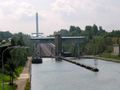
Past a discreet chapel, you descend slowly into the valley of the Samme to reach the bank of the old Charleroi-Brussels canal, an elongated pond (full of fish), at the height of a disappeared ferry. Immediately the beginning of a 3.2 km long and sublime walk on a narrow and winding dirt road surrounded by shrubs and wildflowers. After lock n°26, the path becomes a paved road, the Digue du Canal, you find yourself in Ronquières (part of Braine-le-Comte in Hainaut).
For the bridge over the (new) Charleroi-Brussels canal, you climb quite steeply out of the Samme valley (and the canal).
Past a chapel with a curious Ecce Homo, you walk again in the arable land and enjoy again a wide view of the arable land and the meadow to the south with the dominant tower of 150 m high of the inclined plane, the stretched wood of La Houssière and the (industrial) towers of the industrial area around Feluy as horizons. Gravel becomes asphalt, more gravel and even pure cobblestones from the hell of the north. You walk on an altitude road between field and meadow or cross meadows through gates, you enter and leave the valley of Mathieu Simon stream and pass many chapels. Unnoticed, you find yourself again in Walloon Brabant.
A curious building emerges: the Castia. You have arrived in the charming village of Bornival to descend quickly to ... Trou de Mon Cul (!) and disappear, with a very discreet tunnel, in the valley of the Thines. You cross the fast and surprisingly wide river and find yourself in a sloping meadow through a gate. A beautiful walk through a meadow along the left bank of the meanders of Thines (note: cow flies!) leads through a second gate to a grass path that leads to the impressive Abbey Farm located in the tiny Monstreux, once a centre of watermills along the Thines. You leave its valley and discover the proximity of Nivelles in one view. Bite up the Grand'Place to enjoy a Gertrude Triple in one of the many cafes.
Ist Ihnen auf dieser Route etwas aufgefallen?Problem hinzufügen
Route navigieren in...
 RouteYou-App Öffnen
Diese Werbung nicht mehr anzeigen?
→ Jetzt upgraden

Bitte warten Sie, die Navigation wird vorbereitet.
Sie können jetzt navigieren. Viel Routen-Spaß!
Bearbeitung Ihrer Anfrage ist fehlgeschlagen. Bitte versuchen Sie es erneut.
Diese Werbung nicht mehr anzeigen?
→ Jetzt upgraden
Bitte warten Sie, Ihr Download wird vorbereitet.
Ihr Download ist fertig. Viel Routen-Spaß!
Bearbeitung Ihrer Anfrage ist fehlgeschlagen. Bitte versuchen Sie es erneut.
Diese Werbung nicht mehr anzeigen?
→ Jetzt upgraden
Bitte warten Sie, Ihr Ausdruck wird vorbereitet.
Ihr Ausdruck ist bereit für den Download. Viel Routen-Spaß!
Bearbeitung Ihrer Anfrage ist fehlgeschlagen. Bitte versuchen Sie es erneut.
<iframe src="https://plugin.routeyou.com/routeviewer/free/?language=de&params.route.id=8104705&params.language=en" width="100%" height="600" frameborder="0" allowfullscreen></iframe>
<p><a class="routeYou_embed" href="https://app.routeyou.com/en-be/route/view/8104705?utm_source=embed&utm_medium=article&utm_campaign=routeshare&navigation=external" title="Nivelles-Ronquières: through Pajottenland on its Walloon - RouteYou" target="_blank"><img src="https://image.routeyou.com/embed/route/960x670/8104705-en@2x.png" style="width: 100%; height: auto;" alt="Nivelles-Ronquières: through Pajottenland on its Walloon"></a></p>
Zusätzliches Feedback:
Diese Funktion ist ausschließlich für RouteYou PREMIUM-Abonnenten verfügbar.
Testen Sie 1 Monat kostenlos und entdecken Sie den Unterschied! Wir erfassen keine Zahlungsdaten und Ihre Testversion endet automatisch nach einem Monat.
© 2006-2026 RouteYou - www.routeyou.com



 Grote Routepaden





 Starten
 Herunterladen
 Herunterladen

