Dank unseres Partners VisitBrabant erhältst Du kostenlosen Zugang zu dieser Route - UND Du lernst RouteYou PLUS kennen.
Entdecke alle Vorteile989 Aufrufe | Öffentlich | Deutsch • Französisch • Niederländisch
 Azure
AzureIntersections: 35 - 34 - 62 - 24 - 22 - 21 - 55 - 58 - 57 - 56 - 46 - 48 - 90 - 91 - 81 - 04 - 82 - 79 - 20 - 21 - 64 - 63 - 14 - 23 - 62 - 34 - 36 - 35
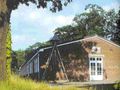
Explore the Linie 1629 cycle route, which follows the remains of historic fortifications and takes you past key sites of the Siege of 's-Hertogenbosch. Discover the military works from the Eighty Years' War and enjoy the beautiful nature and breathtaking views at the same time. Along the route you will find cozy restaurants with terraces where you can relax and enjoy a snack and drink. This beautiful 49-kilometre route crosses 's-Hertogenbosch, Heusden, Sint-Michielsgestel and Vught, and offers a varied experience.
Download the free app
Using the camera on your phone, you can make two war correspondents from the 17th century appear in Augmented Reality (AR). These guides experienced the siege themselves and will tell you about the exciting historical events. They do this from the perspective of the Republic and the Spanish Netherlands. Download the app App store or Android here.
About this route
This cycle route was created by VisitBrabant Routebureau. The route is set out via the Brabant cycle junction system. At each junction you will also find a sign with 'Linie 1629'. Easily cycle from one numbered junction to another. Arrows show you the way between the nodes. Is there something wrong with the signposting of the route? Please let us know via visitbrabant.com/meldpunt. You can also call 0800-4050050 (free of charge).
The cycle route of Linie 1629 has two variants: the main route goes via Maurick Castle in Vught. You can also choose to cycle through the Bossche Broek nature reserve. Both variants can be followed via the route signs.
Roadmap
View this route page on your phone or download the GPX file. Do you want to go out with a paper map? You can order these in our webshop.
Zuiderwaterlinie
The Zuiderwaterlinie is the oldest, longest and most used of all Dutch waterlines. All the way from Bergen op Zoom to Grave. A unique chain of 11 fortified towns in Brabant, connected by the typical Dutch story of defending with the water. Click here for an overview of all cycling and walking routes and read more about the Zuiderwaterlinie.
Ist Ihnen auf dieser Route etwas aufgefallen?Problem hinzufügen
Route navigieren in...
![]() RouteYou-App Öffnen
RouteYou-App Öffnen
![]()
Bitte warten Sie, Ihr Ausdruck wird vorbereitet.
Ihr Ausdruck ist bereit für den Download. Viel Routen-Spaß!
Bearbeitung Ihrer Anfrage ist fehlgeschlagen. Bitte versuchen Sie es erneut.
<iframe src="https://plugin.routeyou.com/routeviewer/free/?language=de&params.route.id=11989709&params.language=en" width="100%" height="600" frameborder="0" allowfullscreen></iframe>
<p><a class="routeYou_embed" href="https://app.routeyou.com/en-nl/route/view/11989709?utm_source=embed&utm_medium=article&utm_campaign=routeshare&navigation=external" title="Linie 1629 cycle route - RouteYou" target="_blank"><img src="https://image.routeyou.com/embed/route/960x670/11989709-en@2x.png" style="width: 100%; height: auto;" alt="Linie 1629 cycle route"></a></p>
Zusätzliches Feedback:
Diese Funktion ist ausschließlich für RouteYou PREMIUM-Abonnenten verfügbar.
Testen Sie 1 Monat kostenlos und entdecken Sie den Unterschied! Wir erfassen keine Zahlungsdaten und Ihre Testversion endet automatisch nach einem Monat.
© 2006-2026 RouteYou - www.routeyou.com