

The Texas Panhandle is a region of the U.S. state of Texas consisting of the northernmost 26 counties in the state. The panhandle is a rectangular area bordered by New Mexico to the west and Oklahoma to the north and east. It is adjacent to the Oklahoma Panhandle. The Handbook of Texas defines the southern border of Swisher County as the southern boundary of the Texas Panhandle region.
Its land area is 25,823.89 sq mi , or nearly 10% of the state's total. The Texas Panhandle is slightly larger in size than the US state of West Virginia. An additional 62.75 sq mi is covered by water. Its population as of the 2010 census was 427,927 residents, or 1.7% of the state's total population. As of the 2010 census, the population density for the region was 16.6 per square mile . However, more than 72% of the Panhandle's residents live in the Amarillo Metropolitan Area, which is the largest and fastest-growing urban area in the region. The Panhandle is distinct from North Texas, which is further south and east.
Datenquelle: Wikipedia.org
Urheberrechte: Creative Commons 3.0
 | | Öffentlich | Deutsch • Französisch • Italienisch • Spanisch

Wählen Sie eine der beliebtesten Aktivitäten unten aus oder verfeinern Sie Ihre Suche.
Entdecken Sie die schönsten und beliebtesten Routen in der Gegend, sorgfältig gebündelt in einer passenden Auswahl.
Wählen Sie eine der unten aufgeführten beliebtesten Kategorien oder lassen Sie sich von unserer Auswahl inspirieren.
Entdecken Sie die schönsten und beliebtesten Sehenswürdigkeiten der Gegend, sorgfältig gebündelt in einer entsprechenden Auswahl.
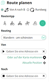
Mit RouteYou kannst du ganz einfach eigene Karten erstellen. Plane deine Route, füge Wegpunkte oder Knotenpunkte hinzu, plane Sehenswürdigkeiten und Einkehrmöglichkeiten ein und teile alles mit Familie und Freunden.
Routenplaner
<iframe src="https://plugin.routeyou.com/poiviewer/free/?language=de&params.poi.id=7696515&params.language=en" width="100%" height="600" frameborder="0" allowfullscreen></iframe>

Mehr als 10.100.000 Routen

Mehr als 15.000.000 Benutzer

Mehr als 4.500.000 Sehenswürdigkeiten

Kerkstraat 108
9050 Gentbrugge,Belgien
© 2006-2026 RouteYou - www.routeyou.com



