

Pfofeld lies in the West Middle Franconia region, about five kilometres east of Gunzenhausen. In the north of the municipality are parts of the Großer Brombachsee and its forebay, the Kleiner Brombachsee, as well as the Altmühlüberleiter channel. In Roman times the limes ran through the area. The European watershed runs through the municipality and divides the catchments of the Rhine and Danube. A stream, the Dornhauser Mühlbach flows through Pfofeld; other local streams include the Bachwiesengraben, the Buxbach and the Brombach. The municipality is characterised by low hills and woods, including the Weißenberg and the Gräfensteinberg Forest. Staatsstraße 2222 runs past Pfofeld to the north. Within the municipality are the nature reserves of Brombachmoor and Halbinsel im Kleinen Brombachsee.
Datenquelle: Wikipedia.org
Urheberrechte: Creative Commons 3.0
 | | Öffentlich | Deutsch • Dänisch • Französisch • Italienisch • Niederländisch • Spanisch

Wählen Sie eine der beliebtesten Aktivitäten unten aus oder verfeinern Sie Ihre Suche.
Entdecken Sie die schönsten und beliebtesten Routen in der Gegend, sorgfältig gebündelt in einer passenden Auswahl.
Datenquelle: HaSe
Urheberrechte: Creative Commons CC BY-SA 4.0
Wählen Sie eine der unten aufgeführten beliebtesten Kategorien oder lassen Sie sich von unserer Auswahl inspirieren.
Entdecken Sie die schönsten und beliebtesten Sehenswürdigkeiten der Gegend, sorgfältig gebündelt in einer entsprechenden Auswahl.
Datenquelle: HaSe
Urheberrechte: Creative Commons CC BY-SA 4.0
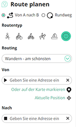
Mit RouteYou kannst du ganz einfach eigene Karten erstellen. Plane deine Route, füge Wegpunkte oder Knotenpunkte hinzu, plane Sehenswürdigkeiten und Einkehrmöglichkeiten ein und teile alles mit Familie und Freunden.
Routenplaner
<iframe src="https://plugin.routeyou.com/poiviewer/free/?language=de&params.poi.id=8076771&params.language=en" width="100%" height="600" frameborder="0" allowfullscreen></iframe>

Mehr als 11.800.000 Routen

Mehr als 15.000.000 Benutzer

Mehr als 4.500.000 Sehenswürdigkeiten

Kerkstraat 108
9050 Gentbrugge,Belgien
© 2006-2026 RouteYou - www.routeyou.com



