

The Cathays electoral ward of Cardiff, created in 1890, which since 1974 has covered the Cathays and Castle communities. There is no community council for the area and it has elected three Cardiff councillors from the outset.
The Cathays ward includes some or all of the following areas: Blackweir, Cardiff city centre, Cathays Park and Maindy in the parliamentary constituency of Cardiff Central. It is bounded by Gabalfa and Birchgrove to the north; Plasnewydd and Adamsdown to the east; Butetown to the south; and Riverside to the west. The River Taff forms its western boundary to where it meets the South Wales Main Line, the South Wales Main Line forms the southern boundary to where it meets the Valley Lines northbound branch, this railway line then forms the eastern boundary as far as the A48 road. The Northern boundary follows the A48 as far as Allensbank Road where it follows this road south then turns north again along Whitchurch Road. It turns west along Crown Way, then south along the A470 until North Road where it bears west, passing just south of the student halls, until it meets the River Taff. The tallest building in Wales is here and is also part of the Cardiff's CBD.
Datenquelle: Wikipedia.org
Urheberrechte: Creative Commons 3.0
 | | Öffentlich
Adresse: Cathays, Cardiff, Vereinigte Königreich
Statistiken
Wählen Sie eine der beliebtesten Aktivitäten unten aus oder verfeinern Sie Ihre Suche.
Entdecken Sie die schönsten und beliebtesten Routen in der Gegend, sorgfältig gebündelt in einer passenden Auswahl.
Datenquelle: Sionk
Urheberrechte: Creative Commons CC BY-SA 4.0
Wählen Sie eine der unten aufgeführten beliebtesten Kategorien oder lassen Sie sich von unserer Auswahl inspirieren.
Entdecken Sie die schönsten und beliebtesten Sehenswürdigkeiten der Gegend, sorgfältig gebündelt in einer entsprechenden Auswahl.
Datenquelle: Sionk
Urheberrechte: Creative Commons CC BY-SA 4.0
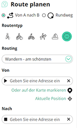
Mit RouteYou kannst du ganz einfach eigene Karten erstellen. Plane deine Route, füge Wegpunkte oder Knotenpunkte hinzu, plane Sehenswürdigkeiten und Einkehrmöglichkeiten ein und teile alles mit Familie und Freunden.
Routenplaner
<iframe src="https://plugin.routeyou.com/poiviewer/free/?language=de&params.poi.id=1522108&params.language=en" width="100%" height="600" frameborder="0" allowfullscreen></iframe>

Mehr als 10.100.000 Routen

Mehr als 15.000.000 Benutzer

Mehr als 4.500.000 Sehenswürdigkeiten

Kerkstraat 108
9050 Gentbrugge,Belgien
© 2006-2026 RouteYou - www.routeyou.com



