Dank unseres Partners Pasar vzw erhältst Du kostenlosen Zugang zu dieser Route - UND Du lernst RouteYou PLUS kennen.
Entdecke alle Vorteile4861 Aufrufe | Öffentlich | Deutsch • Französisch • Niederländisch
 Azure
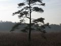
AzureAppointment at the visitor center of Landschap De Liereman in Oud-Turnhout (V). Natuurpunt mapped out 6 signposted hiking trails, which were bundled in a guide (2 EUR). During this walk you make a combination of 5 of those walks and you only walk on unpaved roads. In rainy weather, boots are recommended. You leave with your back to the visitor center and follow the red square of the Echelkuilpad and the green window of the Lieremanpad for a while. Leave the German road on the right and turn left at the junction with the Natuurpunt rest bench. Along the edge of the forest and at a meadow turn right through a sasje. Cross a stream and head into the forest. You walk next to the Aa. Where it makes a right-angled turn to the left, you walk straight ahead. On the left a field, on the right a nature reserve. You go back into the forest and stay at a drive, where hikers of the Lieremanpad have to turn left, walk straight on the narrow path. A little further on you walk through a meadow. On the right, between the trees, you can see the house of the Misonne family, former owner of this 20 ha nature reserve. You step along the bank of the Echelkuil and then (a bit before the end of the pool!) go back into the forest. This is a humid area. You walk on a bat path, cross the Deer Pit Run and walk among the wild gale, which is processed in the Gageleer, the beer of Natuurpunt. At the T-junction with the transverse bat path, turn right. The Lieremanpad runs together with the Echelkuilpad. You walk further over a wide strip of trees and shrubs, which shield the nature reserve from the agricultural land. At a natural gas pipeline (number 116A) you step right through a sasje and walk on a path with shrub heath and heath on the right. Then you step between the reeds on a bat path and cross the Lieremanloop. The weir on the left is important for the water management in the nature reserve. Continue walking until you reach a wide dirt road, the Lieremanweg. Our walk goes left here, but it is worthwhile to first step 200 m to the right to climb the watchtower 1 for a beautiful view over the nature reserve. Then follow the Lieremanweg in the opposite direction of the Duinenpad, past the Kempense stal 2 and into the forest. Ignore the Hoge Mierdse Heide on the right and follow the orange triangles of the Korhaanpad. Leave the Arendonkse Liniedijk behind and continue walking until the T-junction. 100 m to the left is the bird watching platform 3 of nature reserve De Braekeleer. Our walk turns right. You walk through a meadow bird area and on the border of Arendonk and Oud-Turnhout. Cross the Brakeleerloop and turn left at the edge of the forest. Follow the wide forest road until you can turn right into the forest. When you come out, you are in front of a felled piece of forest, where heath restoration is done. You literally walk around this area back to the wide dirt road that you left just now. Follow it to the left until you can walk to the right along a stretch, where heath restoration is also done, to a wide dirt road. Cross it and step into a forest road. At a rest bench, take the first road on the left. The Korhaanpad goes straight ahead here. You now follow the Duinenpad again in the opposite direction. On the T, follow the wire closure of the nature reserve to the left. The path follows the closure to the right and you end up on a wide dirt road with cycle path: the Oude Bergweg. Follow it straight ahead, towards the visitor centre. Then pay attention. Next to the cycle path you will come across a pole with the brown cross of the Vennenpad at the back. Then take the first forest road on the left and follow the Vennenpad in the opposite direction, another 300 to 400 m to the terminus. Keep an eye on the poles and continue walking to the visitor center. You can close with a Gageleer.
Ist Ihnen auf dieser Route etwas aufgefallen?Problem hinzufügen
Route navigieren in...
![]() RouteYou-App Öffnen
RouteYou-App Öffnen
![]()
Bitte warten Sie, Ihr Ausdruck wird vorbereitet.
Ihr Ausdruck ist bereit für den Download. Viel Routen-Spaß!
Bearbeitung Ihrer Anfrage ist fehlgeschlagen. Bitte versuchen Sie es erneut.
<iframe src="https://plugin.routeyou.com/routeviewer/free/?language=de&params.route.id=5367060&params.language=en" width="100%" height="600" frameborder="0" allowfullscreen></iframe>
<p><a class="routeYou_embed" href="https://app.routeyou.com/en-be/route/view/5367060?utm_source=embed&utm_medium=article&utm_campaign=routeshare&navigation=external" title="In the Liereman - RouteYou" target="_blank"><img src="https://image.routeyou.com/embed/route/960x670/5367060-en@2x.png" style="width: 100%; height: auto;" alt="In the Liereman"></a></p>
Zusätzliches Feedback:
Diese Funktion ist ausschließlich für RouteYou PREMIUM-Abonnenten verfügbar.
Testen Sie 1 Monat kostenlos und entdecken Sie den Unterschied! Wir erfassen keine Zahlungsdaten und Ihre Testversion endet automatisch nach einem Monat.
© 2006-2026 RouteYou - www.routeyou.com