

Autry is located some 50 km east of Reims and 25 km north by north-west of Sainte-Menehould. The southern border of the commune is the departmental boundary between Ardennes and Marne. Access to the commune is by road D21 from Challerange in the north-west which passes through the centre of the commune and the village and continues to Binarville in the south-east after changing to the D63 at the departmental border. The D218 goes west from the village to Bouconville and the D41 goes north-east to Lançon. Apart from the village there is the hamlet of La Gare in the west. Large areas of the commune are forested, especially in the west, and there is a large fish farm in the east. The rest of the commune is farmland.
Datenquelle: Wikipedia.org
Urheberrechte: Creative Commons 3.0
 | | Öffentlich | Deutsch • Dänisch • Französisch • Italienisch • Katalanisch • Niederländisch • Spanisch
Adresse: Autry, Champagne-Ardenne, Frankreich
Statistiken
Wählen Sie eine der beliebtesten Aktivitäten unten aus oder verfeinern Sie Ihre Suche.
Entdecken Sie die schönsten und beliebtesten Routen in der Gegend, sorgfältig gebündelt in einer passenden Auswahl.
Datenquelle: François GOGLINS
Urheberrechte: Creative Commons CC BY-SA 3.0
Wählen Sie eine der unten aufgeführten beliebtesten Kategorien oder lassen Sie sich von unserer Auswahl inspirieren.
Entdecken Sie die schönsten und beliebtesten Sehenswürdigkeiten der Gegend, sorgfältig gebündelt in einer entsprechenden Auswahl.
Datenquelle: François GOGLINS
Urheberrechte: Creative Commons CC BY-SA 3.0
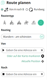
Mit RouteYou kannst du ganz einfach eigene Karten erstellen. Plane deine Route, füge Wegpunkte oder Knotenpunkte hinzu, plane Sehenswürdigkeiten und Einkehrmöglichkeiten ein und teile alles mit Familie und Freunden.
Routenplaner
<iframe src="https://plugin.routeyou.com/poiviewer/free/?language=de&params.poi.id=1333251&params.language=en" width="100%" height="600" frameborder="0" allowfullscreen></iframe>

Mehr als 11.800.000 Routen

Mehr als 15.000.000 Benutzer

Mehr als 4.500.000 Sehenswürdigkeiten

Kerkstraat 108
9050 Gentbrugge,Belgien
© 2006-2026 RouteYou - www.routeyou.com



