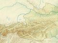
La excursión montañosa de dificultad media con ascenso al pico Hochzeiger, de 2.560 metros de altura, comienza a través del valle Riegetal en Pitztal. El área de protección paisajística es un pequeño tesoro natural con una flora y fauna diversa. Con un poco de suerte, se pueden ver marmotas, salamandras de montaña, rebecos o ovejas, así como numerosas coloridas flores alpinas. El punto culminante de la excursión es sin duda el Groaßsee: en uno de los lagos de montaña más hermosos de todo Pitztal se refleja el imponente Wildgrat, un espectáculo natural inolvidable. La ruta circular hacia el área de protección paisajística Riegetal comienza en la estación intermedia de los teleféricos Hochzeiger. Desde allí se sigue el camino señalizado número 12 en dirección a Zollberg. Desde Zollberg, un estrecho sendero, el "Goaßsteig", parcialmente asegurado con cadenas, desciende hacia el valle Riegetal. Luego se avanza cómodamente hacia el idílico valle alto hasta el Großsee. Después de un descanso en el lago, se regresa un tramo por el mismo camino. Sin embargo, luego se desvía un sendero más empinado hacia la derecha en dirección a Hochzeiger. Arriba, en la cima de Hochzeiger a 2.560 metros sobre el nivel del mar, se registra en el libro de cumbres, antes de que un sendero bien visible conduzca de regreso a la estación intermedia de los teleféricos Hochzeiger.
See something wrong on this route?Add an issue
Navigate route in...
![]() RouteYou app Open
RouteYou app Open
Don't want to see this ad anymore?
→ Upgrade now
![]()
Please wait, the navigation is being prepared.
You can now navigate. Have fun on the road!
Processing your request has failed. Please try again.
Don't want to see this ad anymore?
→ Upgrade now
![]()
Please wait, your download is being prepared.
Your download is ready. Have fun on the road!
Processing your request has failed. Please try again.
Don't want to see this ad anymore?
→ Upgrade now
![]()
Please wait, your print is being prepared.
Your print is ready to download. Have fun on the road!
Processing your request has failed. Please try again.
<iframe src="https://plugin.routeyou.com/routeviewer/free/?language=en&params.route.id=15262295&params.language=es" width="100%" height="600" frameborder="0" allowfullscreen></iframe>
<p><a class="routeYou_embed" href="https://app.routeyou.com/es-at/route/view/15262295?utm_source=embed&utm_medium=article&utm_campaign=routeshare&navigation=external" title="Riegetal - Großsee - Hochzeiger - RouteYou" target="_blank"><img src="https://image.routeyou.com/embed/route/960x670/15262295-es@2x.png" style="width: 100%; height: auto;" alt="Riegetal - Großsee - Hochzeiger"></a></p>
Additional feedback:
This feature is only available to RouteYou PREMIUM subscribers.
Try 1 month for free and discover the difference! We don't take any payment details, and your trial ends automatically after one month.
© 2006-2026 RouteYou - www.routeyou.com