
No, non hai bisogno di aereo oggi. Ma attraverserai comunque villaggi e luoghi come Cina ed Egitto. Il paesaggio aperto dell'altopiano limoso brabanzone ti offre belle vedute e affascinanti valli e villaggi. Bisogna davvero andarci quando c'è bel tempo. Una 'Blanche' fresca è ideale per concludere questa magnifica passeggiata.
PUNTO DI PARTENZA
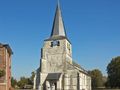
Per la chiesa: lascia l'E40 all'uscita 25-Tienen (Tirlemont) e segui la N29 in direzione di Geldenaken (Jodoigne). Dopo 1 km, gira a destra per il centro città.
PARCHEGGIO
Sulla piazza comunale di fronte al municipio (mercato il sabato).
TIPO DI STRADA
Strade asfaltate, strade di rimaneggiamento, strade a carreggiata separata e sentieri tranquilli.
ACCESSIBILITÀ
Mudoso dopo piogge. Accessibile con passeggini e sedie a rotelle, a patto che tu prenda le varianti dell'itinerario e che non piova.
INFORMAZIONI
Il comune di Hougaerde: Gemeenteplein 1, 3320 Hoegaarden, tel. 016 76 81 80, bart.hendrix@hoegaarden.vera.be, www.vlaanderen.be/hoegaarden.
DA BERE E DA MANGIARE
>-Caffè Den Venetiaen: Gemeenteplein 22, 3320 Hoegaarden, chiuso mar.
-Taverna-Pizzeria Don Camillo: Gemeenteplein 21, 3320 Hoegaarden, tel. 016 76 57 67, www.doncamillo.be, aperto 11:30-22:30, ven.-sab. fino alle 23:30, chiuso mer.
-Taverna-ristorante Kouterhof: Stoopkensstraat 24, 3320 Hoegaarden, tel. 016 76 74 33, fax 016 78 08 35, kouterhofhoegaarden@pandora.be, www.kouterhof.be.
-Caffè Den Broeder: Sint-Ermelindisstraat 19, 3320 Meldert-Hoegaarden.
-Ristorante In de Stoofpot: Sint-Ermelindisstraat 24, 3320 Meldert-Hoegaarden, tel. 016 76 73 04, info@destoofpot.be, www.destoofpot.be/restaurant1.htm, aperto 12:00-14:30 e 18:00-22:00, chiuso lun. e sab. a pranzo.
See something wrong on this route?Add an issue
Navigate route in...
 RouteYou app Open
Don't want to see this ad anymore?
→ Upgrade now

Please wait, the navigation is being prepared.
You can now navigate. Have fun on the road!
Processing your request has failed. Please try again.
Don't want to see this ad anymore?
→ Upgrade now
Please wait, your download is being prepared.
Your download is ready. Have fun on the road!
Processing your request has failed. Please try again.
Don't want to see this ad anymore?
→ Upgrade now
Please wait, your print is being prepared.
Your print is ready to download. Have fun on the road!
Processing your request has failed. Please try again.
<iframe src="https://plugin.routeyou.com/routeviewer/free/?language=en&params.route.id=3194&params.language=it" width="100%" height="600" frameborder="0" allowfullscreen></iframe>
<p><a class="routeYou_embed" href="https://app.routeyou.com/it-be/route/view/3194?utm_source=embed&utm_medium=article&utm_campaign=routeshare&navigation=external" title="``` ``` - RouteYou" target="_blank"><img src="https://image.routeyou.com/embed/route/960x670/3194-it@2x.png" style="width: 100%; height: auto;" alt="``` ```"></a></p>
Additional feedback:
This feature is only available to RouteYou PREMIUM subscribers.
Try 1 month for free and discover the difference! We don't take any payment details, and your trial ends automatically after one month.
© 2006-2026 RouteYou - www.routeyou.com



 Lannoo






 Start
Start Download
 Download

