The Sand Drift Rosmalen is a wooded area southeast of Rosmalen in the Dutch province of North Brabant. It is part of a larger overarching nature area, The Hooge Heide. The area consists of sand drift, heath remnants, and stands of Scots pine. There are also Corsican pines found in the drifting sand area. To the east of the area lies a former landfill, now used as a cornfield.
Sand Drift Rosmalen is squeezed between the A59 and the Rosmalen residential area Sparrenburg. To the east of the Rosmalense sand drift lies the Sparrenburg forest, which is privately owned, while the Rosmalense sand drift is owned by the municipality of 's-Hertogenbosch. To the south of the Rosmalense sand drift are the other areas of the Hooge Heide, namely Coudewater, Wamberg, De Loofaert, Eikenburg forest, Vinkelse forest, the Hooghei, and Engelenstede.
Fuente: Wikipedia
 | | Pública | Alemán • Danés • Español • Francés • Italiano • Neerlandés
Dirección: 's-Hertogenbosch, Noord-Brabant, Países Bajos
Estadísticas
Selecciona una de las actividades más populares a continuación o afina tu búsqueda
Descubre las rutas más bonitas y populares de la zona, cuidadosamente agrupadas y seleccionadas.
Fuente: AvontuurlijkeWandelingen.nl
Selecciona una de las categorías más populares a continuación o inspírate en nuestras selecciones
Descubre los lugares de interés más bonitos y populares de la zona, cuidadosamente agrupados y selecciondos.
Fuente: AvontuurlijkeWandelingen.nl
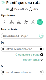
Con RouteYou, es fácil crear tus propios mapas personalizados. Simplemente traza tu ruta, agrega puntos de ruta o nodos, agrega lugares de interés, lugares para comer y beber, y luego compártelo fácilmente con tu familia y amigos.
Planificador de rutas
<iframe src="https://plugin.routeyou.com/poiviewer/free/?language=es&params.poi.id=8250113&params.language=en" width="100%" height="600" frameborder="0" allowfullscreen></iframe>

Más de 11.800.000 rutas

Más de 15.000.000 usuarios

Más de 4.500.000 lugares de interés

Kerkstraat 108
9050 Gentbrugge, Bélgica
© 2006-2026 RouteYou - www.routeyou.com



