Lien copié. Collez le lien dans Instagram pour partager l'itinéraire.

 Azure
Note (2015/05/01): A little further you read that you have to go through the Barebeek with this footpath loop. From the end of July, there is a good chance that this will no longer be necessary: The municipality will relocate the old bridge of footpath 54 over the Barebeek under the impulse of Alderman Van Roey -Slow Roads-. Disadvantage: I will have to seriously lower the 'Difficulty' of this footpath loop (currently 4)....
You can download this original loop in high resolution on an original Atlas map:
http://users.telenet.be/wy/RouteYou/Hofstade_atlaskaart%20rechtgezet%20correcte%20lus%20Atlas%20der%20Buurtwegen%20red.jpg
This allows you to see which was the Voetweg or Buurtweg number of each road, which roads have been added or disappeared, and how the buildings were built around 1840, and experience what it is like today during your trip.
On this Atlas map with route overlay, roads that are not on the Atlas are sometimes necessarily used; which are therefore of a more recent date. These are colored in red.
In a few exceptional situations, the footpaths or neighborhood roads are in a miserable state, have to go through a mudflat or even take a tunnel chute. These difficult points are shown with a blue arrow on the Atlas map.
Some characteristics of the loop 'Hofstade':
Loop data:
distance = 9,7km
distance unpaved =3,9km (40%)
Distance paved (e.g. Dolomite) = 1,8km
distance asphalt etc. = 4km
Part outside the borough of Hofstade:
distance =1km (Weerde) + 0,6km (Zemst) = 1,6km (16% of the total loop)
distance unpaved =1,4km (88%)
distance paved (eg dolomite) = 0km
distance asphalt etc. = 0,2km
You notice that in Hofstade most roads are already paved, and that there are still few original 'unpaved' roads to be found. Fortunately, there is still the Bloso domain at that point, which has a range of paved and unpaved paths.
This loop around Hofstade aims at a route along Footpaths/Neighborhood Roads from the Atlas of Neighborhood Roads. This is the 'public' road network in the period around 1840.
Some of these roads were already located on private land. The maintenance of this road network was a task entrusted to the municipalities.
In that period there was no asphalt/concrete pavement. The only pavement consisted of broken debris and cobblestones used for the larger neighborhood roads. All other roads were unpaved. People moved on foot, by bicycle or by horse cart.
This loop tries to find this originally road network, unpaved mostly, sometimes paved, on the neighborhood and pedestrian roads that can currently still be found in Hofstade. When working out the loop neighborhood and pedestrian roads, AS FEW as possible asphalted roads (= where there is usually motorized traffic) were used.
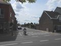
See the POIs where current photos of the loop are included.
Via the 'Download function' you can download the GPX; either view the loop on a topomap or current road map or Google Earth photo map.
In order to offer the walker/runner/cyclist who does not want to do these obstacles a decent loop (who then does not use 'as much' neighborhood and pedestrian roads as possible), there is an obstacle-free alternative for that specific loop:
https://www.routeyou.com/nl/route/view/1870209/wandelroute/autovrije-buurt-en-voetwegen-hofstade-wadvrije-optie.nl
However, don't expect an easy, paved and fast course at every point.
We also always try to stay within the original municipal boundary. Exceptionally, to 'enable' a loop, there is a deviation from this.
Do you want to do the full loop of the merged municipality of Zemst?
Here you have the description, POI order, and distance to cover:
https://www.routeyou.com/nl/route/view/1802614/mountainbikeroute/autovrije-buurt-en-voetwegen-zemst-fusiegemeente.nl
Note that in the 1840s bicycles on asphalt did not yet exist.... And you'll notice.
For the trail runners this is an extreme challenge: try it!
Vous avez remarqué quelque chose sur cet itinéraire ?Ajouter rapport
Parcourir l'itinéraire dans...
 Application RouteYou Ouvrez
Vous ne voulez plus voir cette publicité ?
→ Actualiser maintenant

Veuillez patienter, la navigation est en cours de préparation.
Vous pouvez maintenant naviguer. Bonne route !
Le traitement de la demande a échoué. Veuillez réessayer.
Vous ne voulez plus voir cette publicité ?
→ Actualiser maintenant
Veuillez patienter, votre téléchargement est en cours de préparation.
Votre téléchargement est prêt. Bonne route !
Le traitement de la demande a échoué. Veuillez réessayer.
Vous ne voulez plus voir cette publicité ?
→ Actualiser maintenant
Veuillez patienter, votre impression est en cours de préparation.
Votre impression est prête à être téléchargée. Bonne route !
Le traitement de la demande a échoué. Veuillez réessayer.
Commentaires supplémentaires :
Cette fonctionnalité est exclusivement disponible pour les abonnés RouteYou PREMIUM.
Essayez 1 mois gratuit maintenant et découvrez la différence ! Nous n'exigeons aucune donnée de paiement et le service s'arrête automatiquement après votre période d'essai d'un mois.
© 2006-2026 RouteYou - www.routeyou.com


 wy




 Démarrer
 Télécharger
 Télécharger


