Lien copié. Collez le lien dans Instagram pour partager l'itinéraire.

Pleasant jogging route with ample parking available on the north side.
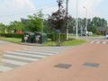
The exact running distance is 1550 m, almost 1 mile (1609 m), measured with a calibrated bicycle on the inside of the path (and the shortest distance between the curves). On the south side, you must leave the information board and the trash container on your left when running counterclockwise; thus, you go all the way up the hill behind the trees and the container, and do not take the shortcut.
There are picnic areas to the north and northeast. To the east, there is a bird-watching station (follow the stilts for this). From all four directions, there is a beautiful view of the fish pond.
In very wet weather, it can sometimes be slippery at the northern curve.
When running the loop counterclockwise, the (short) southern running direction is mostly uphill. The (longer) northern running direction then has two short inclines.
Vous avez remarqué quelque chose sur cet itinéraire ?Ajouter rapport
Parcourir l'itinéraire dans...
 Application RouteYou Ouvrez
Vous ne voulez plus voir cette publicité ?
→ Actualiser maintenant

Veuillez patienter, la navigation est en cours de préparation.
Vous pouvez maintenant naviguer. Bonne route !
Le traitement de la demande a échoué. Veuillez réessayer.
Vous ne voulez plus voir cette publicité ?
→ Actualiser maintenant
Veuillez patienter, votre téléchargement est en cours de préparation.
Votre téléchargement est prêt. Bonne route !
Le traitement de la demande a échoué. Veuillez réessayer.
Vous ne voulez plus voir cette publicité ?
→ Actualiser maintenant
Veuillez patienter, votre impression est en cours de préparation.
Votre impression est prête à être téléchargée. Bonne route !
Le traitement de la demande a échoué. Veuillez réessayer.
Commentaires supplémentaires :
Cette fonctionnalité est exclusivement disponible pour les abonnés RouteYou PREMIUM.
Essayez 1 mois gratuit maintenant et découvrez la différence ! Nous n'exigeons aucune donnée de paiement et le service s'arrête automatiquement après votre période d'essai d'un mois.
© 2006-2026 RouteYou - www.routeyou.com


 wy




 Démarrer
 Télécharger
 Télécharger


