Lien copié. Collez le lien dans Instagram pour partager l'itinéraire.

 Azure
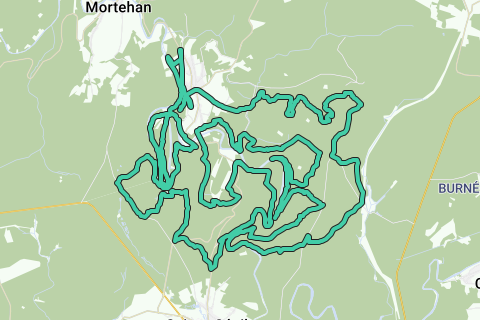
Le Tombeau du Chevalier trail (58.76 km; D+ 2100m); southern version Herbeumont.
Based on http://www.festival-trail-semois.be/index.php's latest trail 'under construction' data, NGI topographic maps, own knowledge of the area and GPX records of the most important parts of the trail. The current trail eventually became not this one, but the north trail.
Following the Semois between Les Mauleûx and La Roche du Chat, I deviated from the path under construction and followed the forest path along the Semois to the south, after which the ascent begins north to Rue des Épioux along a forest road.
The flat distance is therefore 57km, the actual distance that takes into account the elevations to be covered is 58.76km; The altimeters to overcome are 2100m. See the first POI of this loop (Topographic Data The Knight's Tomb) for a detailed map and figures.
This trail is highly recommended for athletes who like to stay in the forest and who like an altitude difference of more than 2000m over more than 55km.
Vous avez remarqué quelque chose sur cet itinéraire ?Ajouter rapport
Parcourir l'itinéraire dans...
 Application RouteYou Ouvrez
Vous ne voulez plus voir cette publicité ?
→ Actualiser maintenant

Veuillez patienter, la navigation est en cours de préparation.
Vous pouvez maintenant naviguer. Bonne route !
Le traitement de la demande a échoué. Veuillez réessayer.
Vous ne voulez plus voir cette publicité ?
→ Actualiser maintenant
Veuillez patienter, votre téléchargement est en cours de préparation.
Votre téléchargement est prêt. Bonne route !
Le traitement de la demande a échoué. Veuillez réessayer.
Vous ne voulez plus voir cette publicité ?
→ Actualiser maintenant
Veuillez patienter, votre impression est en cours de préparation.
Votre impression est prête à être téléchargée. Bonne route !
Le traitement de la demande a échoué. Veuillez réessayer.
Commentaires supplémentaires :
Cette fonctionnalité est exclusivement disponible pour les abonnés RouteYou PREMIUM.
Essayez 1 mois gratuit maintenant et découvrez la différence ! Nous n'exigeons aucune donnée de paiement et le service s'arrête automatiquement après votre période d'essai d'un mois.
© 2006-2026 RouteYou - www.routeyou.com



 wy



 Démarrer
 Télécharger
 Télécharger


