Link copiato. Incolli il link su Instagram per condividere l'itinerario.

 Azure
AzurePreliminary some features of the loop 'Hofstade without mudflats':
Loop data:
distance = 8,7km
distance unpaved =2,7km (31%)
Distance paved (e.g. Dolomite) = 1,8km
distance asphalt etc. = 4,2km
Part outside the borough of Hofstade:
distance =1km (Weerde) + 0,6km (Zemst) = 1,6km (18% of the total loop)
distance unpaved =1,4km (88%)
distance paved (eg dolomite) = 0km
distance asphalt etc. = 0,2km
This loop is a custom loop of https://www.routeyou.com/nl/route/view/1861248/wandelroute/autovrije-buurt-en-voetwegen-hofstade.nl (read its description!)
She avoids a passage through the Barebeek, something adventurous that some people do not like. This is of course at the expense of a longer passage along roads that were not Neighborhood or Pedestrian Roads from the Atlas of Neighborhood Roads.
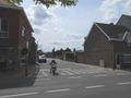
See the POIs where current photos of the loop are included.
Via the 'Download function' you can download the GPX; either view the loop on a topomap or current road map or Google Earth photo map.
You can also download this custom loop in high resolution on an original Atlas map:
http://users.telenet.be/wy/RouteYou/Hofstade_atlaskaart%20rechtgezet%20correcte%20lus%20zonder%20wad%20Atlas%20der%20Buurtwegen%20red.jpg
This allows you to see which was the Voetweg or Buurtweg number of each road, which roads have been added or disappeared, and how the buildings were built around 1840, and experience what it is like today during your trip.
On this Atlas map with route overlay, roads that are not on the Atlas are sometimes necessarily used; which are therefore of a more recent date. These are colored in red.
In a few exceptional situations, the footpaths or neighborhood roads are in a miserable state, have to go through a mudflat or even take a tunnel chute. These difficult points are shown with a blue arrow on the Atlas map.
However, don't expect an easy, paved and fast course at every point. Hofstade is a big exception, however, only 31% are unpaved, the majority of which is outside Hofstade.
We also always try to stay within the original municipal boundary. Exceptionally, to 'enable' a loop, there is a deviation from this.
Do you want to do the full loop (excluding the 'wet passages') of the merged municipality of Zemst?
Here you have the description, POI order, and distance to cover:
https://www.routeyou.com/nl/route/view/1802614/mountainbikeroute/autovrije-buurt-en-voetwegen-zemst-fusiegemeente.nl
Note that in the 1840s bicycles on asphalt did not yet exist.... And you'll notice.
For the trail runners, this is an extreme challenge.
Hai notato qualcosa su questo itinerario?Aggiungere un problema
Naviga nel percorso in...
 App RouteYou Aprire
Vuoi smettere di vedere questo annuncio?
→ Upgrade ora

Attendi, la navigazione è in preparazione.
Ora puoi navigare. Buon divertimento in viaggio!
Elaborazione della richiesta non è riuscita. Si prega di riprovare.
Vuoi smettere di vedere questo annuncio?
→ Upgrade ora
Attendi, il tuo download è in preparazione.
Il tuo download è pronto. Buon divertimento in viaggio!
Elaborazione della richiesta non è riuscita. Si prega di riprovare.
Vuoi smettere di vedere questo annuncio?
→ Upgrade ora
Attendi, la tua stampa è in preparazione.
La tua stampa è pronta per il download. Buon divertimento in viaggio!
Elaborazione della richiesta non è riuscita. Si prega di riprovare.
Altri commenti:
Questa funzionalità è disponibile esclusivamente per gli abbonati a RouteYou PREMIUM.
Prova 1 mese gratis e scopri la differenza! Non prendiamo alcun dettaglio di pagamento e la tua prova termina automaticamente dopo un mese.
© 2006-2026 RouteYou - www.routeyou.com



 wy
wy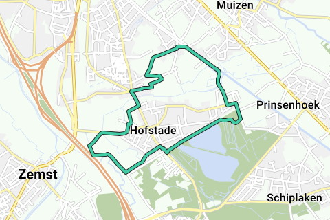






 Comincia
 Scarica
 Scarica

