
On the Devil's Path, you can experience the impressive nature of Saxony-Anhalt up close. This challenging hike of 24.1 kilometers takes you through an almost untouched environment, where you can discover the Little Brocken and the Brocken clock. With 1038 meters of elevation, the route challenges your body and rewards you with breathtaking views. The route is well-marked and mostly car-free, allowing you to fully concentrate on the beauty of nature. You wander alongside bodies of water and avoid urban areas while enjoying the silence and peace of nature. Most sections are unpaved, making the adventure perfect. Get ready for an unforgettable hike!
Hai notato qualcosa su questo itinerario?Aggiungere un problema
Naviga nel percorso in...
 App RouteYou Aprire
Vuoi smettere di vedere questo annuncio?
→ Upgrade ora

Attendi, la navigazione è in preparazione.
Ora puoi navigare. Buon divertimento in viaggio!
Elaborazione della richiesta non è riuscita. Si prega di riprovare.
Vuoi smettere di vedere questo annuncio?
→ Upgrade ora
Attendi, il tuo download è in preparazione.
Il tuo download è pronto. Buon divertimento in viaggio!
Elaborazione della richiesta non è riuscita. Si prega di riprovare.
Vuoi smettere di vedere questo annuncio?
→ Upgrade ora
Attendi, la tua stampa è in preparazione.
La tua stampa è pronta per il download. Buon divertimento in viaggio!
Elaborazione della richiesta non è riuscita. Si prega di riprovare.
<iframe src="https://plugin.routeyou.com/routeviewer/free/?language=it&params.route.id=4376738&params.language=en" width="100%" height="600" frameborder="0" allowfullscreen></iframe>
<p><a class="routeYou_embed" href="https://app.routeyou.com/en-de/route/view/4376738?utm_source=embed&utm_medium=article&utm_campaign=routeshare&navigation=external" title="Devil's Trail - RouteYou" target="_blank"><img src="https://image.routeyou.com/embed/route/960x670/4376738-en@2x.png" style="width: 100%; height: auto;" alt="Devil's Trail"></a></p>
Altri commenti:
Questa funzionalità è disponibile esclusivamente per gli abbonati a RouteYou PREMIUM.
Prova 1 mese gratis e scopri la differenza! Non prendiamo alcun dettaglio di pagamento e la tua prova termina automaticamente dopo un mese.
© 2006-2026 RouteYou - www.routeyou.com



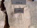
 Auf dem Weg in Deutschland






 Comincia
 Scarica
 Scarica

