

Méjannes-le-Clap is a commune in the Gard department in southern France. It is located 30 km north east of Alès, close to the river Cèze. It is a centre for outdoor activities and environmental tourism.Méjannes-le-Clap has a hot-summer Mediterranean climate . The average annual temperature in Méjannes-le-Clap is 13.6 °C . The average annual rainfall is 1,000.8 mm with October as the wettest month. The temperatures are highest on average in July, at around 23.1 °C , and lowest in January, at around 5.2 °C . The highest temperature ever recorded in Méjannes-le-Clap was 42.6 °C on 28 June 2019; the coldest temperature ever recorded was −11.7 °C on 15 December 2001.
Risorsa: Wikipedia.org
Diritti d'autore: Creative Commons 3.0
 | | Pubblica | Catalano • Danese • Francese • Italiano • Olandese • Spagnolo • Tedesco
Indirizzo: Méjannes-le-Clap, Languedoc-Roussillon, Francia
Statistiche
Seleziona una delle attività più popolari qui sotto oppure affina la ricerca.
Scopri gli itinerari più belli e popolari della zona, accuratamente raggruppati in apposite selezioni.
Risorsa: Clem Rutter, Rochester, Kent
Diritti d'autore: Creative Commons CC BY 3.0
Seleziona una delle categorie più popolari qui sotto o lasciati ispirare dalla nostra selezione.
Scopri i luoghi di interesse più belli e popolari della zona, accuratamente raggruppati in apposite selezioni.
Risorsa: Clem Rutter, Rochester, Kent
Diritti d'autore: Creative Commons CC BY 3.0
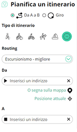
Con RouteYou puoi creare facilmente mappe personalizzate. Traccia il tuo itinerario, aggiungi waypoint o nodi, luoghi di interesse e di ristoro, e condividi le mappe con la tua famiglia e i tuoi amici.
Pianificatore di itinerari
<iframe src="https://plugin.routeyou.com/poiviewer/free/?language=it&params.poi.id=1327679&params.language=en" width="100%" height="600" frameborder="0" allowfullscreen></iframe>

Più di 11.800.000 itinerari

Più di 15.000.000 utenti

Più di 4.500.000 luoghi d'interesse

Kerkstraat 108
9050 Gentbrugge, Belgio
© 2006-2026 RouteYou - www.routeyou.com



