

Speen is a village and civil parish in West Berkshire, England. Centred 2 miles north west of the largest town in the district, Newbury, Speen has clustered settlements, the largest of which is Speen village and the others are buffered from the town by the A34 road and named Bagnor, Stockcross, Woodspeen and Marsh Benham. Its other land is an approximately even mixture of woodland and agricultural fields and varies greatly in elevation, having the Reading to Taunton Line alongside the north bank of the River Kennet as its southern boundary and both banks of the River Lambourn in its north with elevated ground in between. Benham Park in the south-west of the area is a listed landscape garden and house.
Risorsa: Wikipedia.org
Diritti d'autore: Creative Commons 3.0
 | | Pubblica | Danese • Francese • Italiano • Olandese • Spagnolo • Tedesco
Indirizzo: Speen, West Berkshire, Regno Unito
Statistiche
Seleziona una delle attività più popolari qui sotto oppure affina la ricerca.
Scopri gli itinerari più belli e popolari della zona, accuratamente raggruppati in apposite selezioni.
Risorsa: Matthew Prior
Diritti d'autore: Creative Commons CC BY-SA 4.0
Seleziona una delle categorie più popolari qui sotto o lasciati ispirare dalla nostra selezione.
Scopri i luoghi di interesse più belli e popolari della zona, accuratamente raggruppati in apposite selezioni.
Risorsa: Matthew Prior
Diritti d'autore: Creative Commons CC BY-SA 4.0
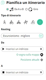
Con RouteYou puoi creare facilmente mappe personalizzate. Traccia il tuo itinerario, aggiungi waypoint o nodi, luoghi di interesse e di ristoro, e condividi le mappe con la tua famiglia e i tuoi amici.
Pianificatore di itinerari
<iframe src="https://plugin.routeyou.com/poiviewer/free/?language=it&params.poi.id=1530889&params.language=en" width="100%" height="600" frameborder="0" allowfullscreen></iframe>

Più di 11.800.000 itinerari

Più di 15.000.000 utenti

Più di 4.500.000 luoghi d'interesse

Kerkstraat 108
9050 Gentbrugge, Belgio
© 2006-2026 RouteYou - www.routeyou.com



