Risorsa: Wandelengel


The Belgian Coast, as part of the Flemish Coast or Coastal Region, is the land area where Belgium borders the North Sea. The length is 65 kilometers and includes a sandy beach that is up to 500 meters wide, with a dune belt behind it that is up to 2.5 kilometers wide. In the northeast, the Zwin forms the border with the Dutch part of the Flemish coast. Here, it transitions into the coast of Zeelandic Flanders. In the southwest, the Flemish coastline merges into the French Opal Coast, which in French Flanders, in French Dunkirk, and east of it is also referred to as the French "Côte Flamande." Behind the coastal strip, further inland, lie the Polders. Together, these polders and the coast form Maritime Flanders in both Belgium and French and Zeelandic Flanders.
Risorsa: Wikipedia.org
Diritti d'autore: Creative Commons 3.0
 | | Pubblica | Danese • Francese • Italiano • Olandese • Spagnolo • Tedesco

Seleziona una delle attività più popolari qui sotto oppure affina la ricerca.
Scopri gli itinerari più belli e popolari della zona, accuratamente raggruppati in apposite selezioni.
Risorsa: Wandelengel
Seleziona una delle categorie più popolari qui sotto o lasciati ispirare dalla nostra selezione.
Scopri i luoghi di interesse più belli e popolari della zona, accuratamente raggruppati in apposite selezioni.
Risorsa: Wandelengel
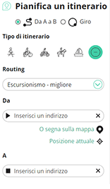
Con RouteYou puoi creare facilmente mappe personalizzate. Traccia il tuo itinerario, aggiungi waypoint o nodi, luoghi di interesse e di ristoro, e condividi le mappe con la tua famiglia e i tuoi amici.
Pianificatore di itinerari
<iframe src="https://plugin.routeyou.com/poiviewer/free/?language=it&params.poi.id=1669790&params.language=en" width="100%" height="600" frameborder="0" allowfullscreen></iframe>

Più di 11.800.000 itinerari

Più di 15.000.000 utenti

Più di 4.500.000 luoghi d'interesse

Kerkstraat 108
9050 Gentbrugge, Belgio
© 2006-2026 RouteYou - www.routeyou.com



