Link copiato. Incolli il link su Instagram per condividere l'itinerario.

 Azure
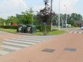
This trail of 14km runs along the Robert Schumanlaan in Zemst. This road is one of the roads that was created during the realization of the E19. It cuts Weerde in half and functioned as a short pseudo-highway years ago. North of the E19, this road remains particularly dangerous for slow road users.
In contrast to this traffic-busy dangerous road, this trail loop goes along all possible green stretches around the Schumanlaan. This makes this trail a unique experience around the borough of Weerde. Regularly busy car traffic, but also regular quiet places in pure nature, as well as several very beautiful views.
The loop uses unpaved trails as much as possible, and at a few points it's easy roadside climbing and biting teeth.
After the growth spurt, high nettles can occur in a few places in spring and summer, then wear high stockings or long pants. In autumn and winter, this loop is definitely recommended on weekends!
A few POINTS OF ATTENTION:
1. At the starting location of the GPX (this is at the Glkasbakken in Weerde -Schumanlaan-Galgenberg at the Visput)) cross the Shumanlaan: Beware.
2. On leaving the Senne richtion E19, take Route 4 (Heirbaan) (Atlas der Buurtwegen) interrupted by the E19. No on the E19 on the left the field path and along the grass meadow you take in the bend straight up (ditch in bush) to the driveway of the E19 on the Shumanlaan. Stay there on the right side of the guardrails and cross the highway.
Beware at the entrances and exits!
3. 100m past the last exit there is an undercut for slow road users. Go over the guardrails and downhill to the Broekstraat which you take on the right.
You arrive at the Barebeek and follow it as long as possible, until you finally come back to the Schumanlaan (ditch!) together with the Barebeek.
4. Cross the Barebeek there, but also stay there on the right side of the guardrails (a pit at the start of the bridge)!) and go under the big road sign.
5. At the intersection (with Bloso domain entrance) there is a staircase just before the lights on the right. Take it and cross under the Schumanlaan. On the other side you follow the tervuursestenweg for another 50m and take the footpath to the Bloso domain.
6. When leaving the Bloso domain (northwest at Hofstade station) cross the Tervuursesteenweg (Beware!) and follow the railway line 27b.
Just over the concrete Zenne bridge under the tracks and then to the left, across the railway line, to take some beautiful Zennemeanders with you.
7. On the E19 back on the right follow the E19 towards the railway line, back the tracks underneath along the right side of the E19 -north-direction-, and then onto the railway embankment: ABOVE WATCH OUT FOR ARRIVING TRAIN TRAFFIC (WAITING). AT YOUR OWN RISK go via the steel path over the E19, and then back down the roadside, and back under the tracks along the right side of the E19 -south direction-.
Have fun with this occasionally tough trail!
Hai notato qualcosa su questo itinerario?Aggiungere un problema
Naviga nel percorso in...
 App RouteYou Aprire
Vuoi smettere di vedere questo annuncio?
→ Upgrade ora

Attendi, la navigazione è in preparazione.
Ora puoi navigare. Buon divertimento in viaggio!
Elaborazione della richiesta non è riuscita. Si prega di riprovare.
Vuoi smettere di vedere questo annuncio?
→ Upgrade ora
Attendi, il tuo download è in preparazione.
Il tuo download è pronto. Buon divertimento in viaggio!
Elaborazione della richiesta non è riuscita. Si prega di riprovare.
Vuoi smettere di vedere questo annuncio?
→ Upgrade ora
Attendi, la tua stampa è in preparazione.
La tua stampa è pronta per il download. Buon divertimento in viaggio!
Elaborazione della richiesta non è riuscita. Si prega di riprovare.
Altri commenti:
Questa funzionalità è disponibile esclusivamente per gli abbonati a RouteYou PREMIUM.
Prova 1 mese gratis e scopri la differenza! Non prendiamo alcun dettaglio di pagamento e la tua prova termina automaticamente dopo un mese.
© 2006-2026 RouteYou - www.routeyou.com


 wy




 Comincia
 Scarica
 Scarica


