

Pfofeld lies in the West Middle Franconia region, about five kilometres east of Gunzenhausen. In the north of the municipality are parts of the Großer Brombachsee and its forebay, the Kleiner Brombachsee, as well as the Altmühlüberleiter channel. In Roman times the limes ran through the area. The European watershed runs through the municipality and divides the catchments of the Rhine and Danube. A stream, the Dornhauser Mühlbach flows through Pfofeld; other local streams include the Bachwiesengraben, the Buxbach and the Brombach. The municipality is characterised by low hills and woods, including the Weißenberg and the Gräfensteinberg Forest. Staatsstraße 2222 runs past Pfofeld to the north. Within the municipality are the nature reserves of Brombachmoor and Halbinsel im Kleinen Brombachsee.
Risorsa: Wikipedia.org
Diritti d'autore: Creative Commons 3.0
 | | Pubblica | Danese • Francese • Italiano • Olandese • Spagnolo • Tedesco

Seleziona una delle attività più popolari qui sotto oppure affina la ricerca.
Scopri gli itinerari più belli e popolari della zona, accuratamente raggruppati in apposite selezioni.
Risorsa: HaSe
Diritti d'autore: Creative Commons CC BY-SA 4.0
Seleziona una delle categorie più popolari qui sotto o lasciati ispirare dalla nostra selezione.
Scopri i luoghi di interesse più belli e popolari della zona, accuratamente raggruppati in apposite selezioni.
Risorsa: HaSe
Diritti d'autore: Creative Commons CC BY-SA 4.0
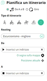
Con RouteYou puoi creare facilmente mappe personalizzate. Traccia il tuo itinerario, aggiungi waypoint o nodi, luoghi di interesse e di ristoro, e condividi le mappe con la tua famiglia e i tuoi amici.
Pianificatore di itinerari
<iframe src="https://plugin.routeyou.com/poiviewer/free/?language=it&params.poi.id=8076771&params.language=en" width="100%" height="600" frameborder="0" allowfullscreen></iframe>

Più di 11.800.000 itinerari

Più di 15.000.000 utenti

Più di 4.500.000 luoghi d'interesse

Kerkstraat 108
9050 Gentbrugge, Belgio
© 2006-2026 RouteYou - www.routeyou.com



