The Giesel is a roughly 10 km long left tributary of the Fulda, which originates in the district of Giesel at 409 m NN. Its primary upper course, also named Gresel, drains, together with its left tributary Saurode and its right tributary, also named Giesel, approximately the eastern half of the Giesel Forest, a large contiguous forest area covering 4,259.6 ha in the eastern part of the Lower Vogelsberg and west of the Fulda depression. It flows into the Fulda in the northern part of the Fulda district of Bronnzell, north and not far from the 215 m long sandstone bridge Kohlhäuser Brücke with over 10 arches at Kohlhaus. The longitudinal profile of the Giesel from its source to its confluence with the Fulda shows a height difference of 156 m.
Risorsa: Wikipedia.org
Diritti d'autore: Creative Commons 3.0
 | | Pubblica | Danese • Francese • Italiano • Olandese • Spagnolo • Tedesco
Indirizzo: Fulda, Germania
Statistiche
Seleziona una delle attività più popolari qui sotto oppure affina la ricerca.
Scopri gli itinerari più belli e popolari della zona, accuratamente raggruppati in apposite selezioni.
Seleziona una delle categorie più popolari qui sotto o lasciati ispirare dalla nostra selezione.
Scopri i luoghi di interesse più belli e popolari della zona, accuratamente raggruppati in apposite selezioni.
Con RouteYou puoi creare facilmente mappe personalizzate. Traccia il tuo itinerario, aggiungi waypoint o nodi, luoghi di interesse e di ristoro, e condividi le mappe con la tua famiglia e i tuoi amici.
Pianificatore di itinerari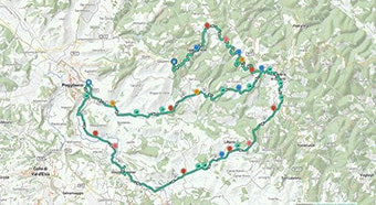
<iframe src="https://plugin.routeyou.com/poiviewer/free/?language=it&params.poi.id=1381387&params.language=en" width="100%" height="600" frameborder="0" allowfullscreen></iframe>

Più di 11.800.000 itinerari

Più di 15.000.000 utenti

Più di 4.500.000 luoghi d'interesse

Kerkstraat 108
9050 Gentbrugge, Belgio
© 2006-2026 RouteYou - www.routeyou.com