

The Singscheider Höhe is a hill directly along the Deilbach just past Kupferdreh. The road can be climbed from both the west and east.
From the western side, the climb is 700 meters long and gains 60 meters in altitude. From the eastern side, the climb is about 400 meters long with around 50 meters of elevation. The eastern side is the steepest (up to 20%). The asphalted road over the Singscheider Höhe is narrow. From the top, there is a view over the Ruhr valley. Be careful when descending from both sides (steep and narrow road, with unclear curves).
 | | Pubblica | Danese • Francese • Italiano • Olandese • Spagnolo • Tedesco

Seleziona una delle attività più popolari qui sotto oppure affina la ricerca.
Scopri gli itinerari più belli e popolari della zona, accuratamente raggruppati in apposite selezioni.
Seleziona una delle categorie più popolari qui sotto o lasciati ispirare dalla nostra selezione.
Scopri i luoghi di interesse più belli e popolari della zona, accuratamente raggruppati in apposite selezioni.
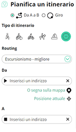
Con RouteYou puoi creare facilmente mappe personalizzate. Traccia il tuo itinerario, aggiungi waypoint o nodi, luoghi di interesse e di ristoro, e condividi le mappe con la tua famiglia e i tuoi amici.
Pianificatore di itinerari
<iframe src="https://plugin.routeyou.com/poiviewer/free/?language=it&params.poi.id=3233760&params.language=en" width="100%" height="600" frameborder="0" allowfullscreen></iframe>

Più di 11.800.000 itinerari

Più di 15.000.000 utenti

Più di 4.500.000 luoghi d'interesse

Kerkstraat 108
9050 Gentbrugge, Belgio
© 2006-2026 RouteYou - www.routeyou.com



