524 keer bekeken | Publiek | Duits • Frans • Nederlands
From Denkmalstraße 1a, 02692 Großpostwitz/O.L., Saxony, Germany
To Pielitz 20, 02627 Kubschütz, Saxony, Germany
Routing Hiking - the most beautiful
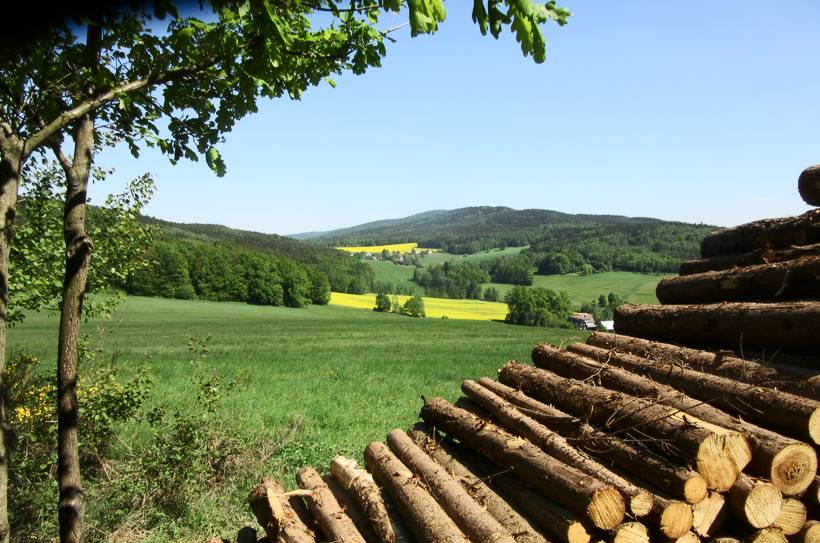
Ebendörfel - Drohmberg - Schmoritz - Rote Schenke ![]()
Ebendörfel-War Memorial-Drohmberg/Silvesterbahn-Echo-Schmoritz/Summit-Sheep Mountain-Rote Schenke (4 km)
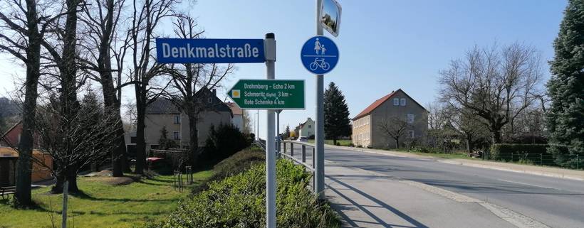
In Ebendörfel, the marked hiking trail with the yellow dot begins at the junction of Denkmalstraße from the B96 (Bautzener Straße).
In the past, the district of Großpostwitz had 2 inns: Elle and KInd (a mixed goods store with an inn, formerly Hantusch). Today, we have to carry provisions in our backpack because we can only rest at the Rote Schenke (except Mondays and Tuesdays).
The Drohmberg, however, never had an alpine inn. In 1884, the Bautzener Mountain Club decided, after careful consideration, to choose the Mönchswalder Berg (which we always called "der Mönchser") because it had a good railway connection with 4 stations. The legendary innkeeper Gerhard Köhler also considered in 1931, when he came from Wehrsdorf to Rascha, whether to build an inn on the Drohmberg or to take over the existing one at the foot of the mountain. As he assured me once, his decision for the inn "Zum Drohmberg" down in Rascha was the right one. Much more support, indeed year-round, was linked to its location on the trunk road 96 from Zittau to Sassnitz.
Birthplace of M. Rostock 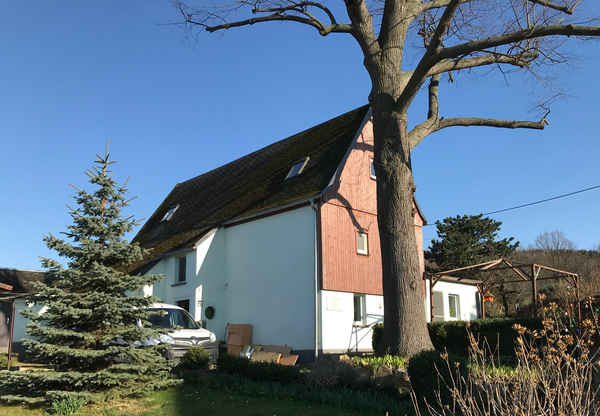
As we walk up Denkmalstraße, we pass the birthplace of researcher Michał Rostok (1821–1893). The house was built around 1800.
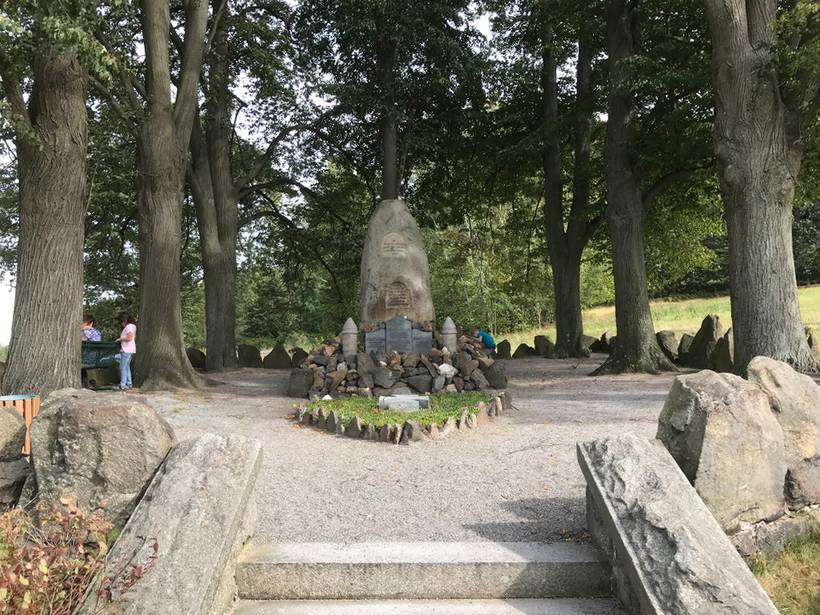
We arrive at the war memorial of Ebendörfel for the fallen in World War I. Right next to it used to be where the witch burnings took place (Walpurgis). Here we also encounter the King's Trail, which encircles the Drohmberg. A great view opens up, especially to the north, towards the nearby Upper Lusatian capital Bautzen, which was officially called Budissin until 1868. The view extends further north to the heathland with its large pine forests.
The local area of Ebendörfel extends over the summit of Drohmberg, even down to the Kunitzer Water, with the village being owned by the Bautzen cathedral chapter from 1400 to 1842.
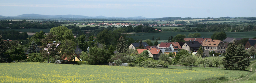
Ebendörfel seen from the memorial
We enter the forest and hike gently uphill, later we turn right, it gets a bit steeper and we walk along the old boundary to Binnewitz. Everywhere, the spruce forest suffered greatly in the dry and hot years of 2018 and 2019. The bark beetle was able to spread significantly. Storms contributed to this, and thus, in 2020, large-scale devastation of the spruce stands occurred.
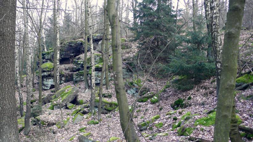
When we reach the summit region, boundary stones to Binnewitz stand at the left side of the path. We soon encounter the Silvesterbahn. A detour to the right to the Drohmberg summit with the Devil's Pulpit (here is a new plaque from the Drohmberg friends installed in 2023) is marked. Our hiking trail now drops to the east. Just before the edge of the forest, we reach the old Kleinkunitzer land. At the edge of the forest, besides the beautiful view to the southeast towards the Hromadnik-Czorneboh massif, there is also the Echo.
At the Echo with a view of the Czorneboh
The old church path over the "Almwiese" at the saddle between Drohmberg and Schmoritz is supposed to be used less today (wish of the landowner), therefore we continue left along the edge of the forest (yellow dot). Below, we meet the Siebenhügelweg (green line), which leads from Bautzen to Bieleboh. For a while, the two color markings guide us together, while we keep to the right.
Now we have reached the junction to Schmoritz, and our yellow dot turns left into the forest. Thus, we are on the old land of Mehlteuer. We keep slightly left and on a nearly straight path, slightly ascending, we reach the summit of Schmoritz at 412 m. The Sorbian name for the mountain is Šmorc or Zmorc. The new plaque, erected in 2023 by the municipality of Großpostwitz and the Drohmberg friends from Rascha and Ebendörfel, tells us details.
The city of Budissin purchased the timber-rich mountain together with Mehlteuer in 1584. On the mountain, there is a medieval fortification and interesting stone mounds.
The summit of Schmoritz
The actual summit region (southern side) was a so-called hill fort, meaning that from around 1160 to no later than 1225 it served as a residence (R. Spehr) likely to secure old trade routes from Budissin to Cunewalde and beyond.
The expanded summit region of Schmoritz extends over almost a kilometer to the southeast down to Sheep Mountain (380 m).
We see Sheep Mountain to the right as we step out of the Schmoritz forest. The mountain was the pasture of the manor Pielitz, which had a sheep farm in Großkunitz.
But to the left below stands the Rote Schenke, which we reach like in a fairy tale land "behind the 7 mountains", even if it was only 3 mountains that we had to cross.
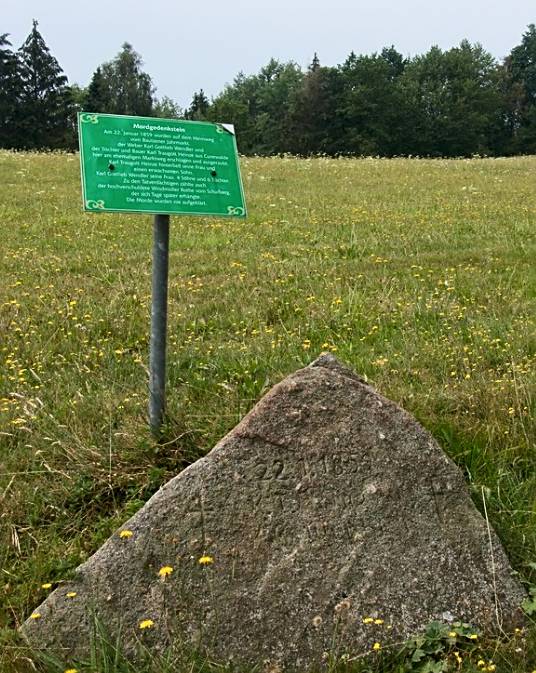
Murder Stone at the Rote Schenke
Here comes the old court and market road from Bautzen, which led over the Schönberger Pass to Cunewalde and from there further to Zittau. An inn was built along this once heavily used path in 1809, called the Sheep Inn. Today, the hiking path with the yellow line runs here.
In 1859, the name Rote Schenke emerged, possibly due to the bloodshed during the fights of the usurper Napoleon against the Russians, who supported the Prussians during the Wars of Liberation, in 1813 at the pass from Mehlteuer to Pielitz. The wounded came here.
There is also a murder stone next to it, which refers to a miller named Rothe from the former Schafbergmühle, who murdered 2 passing Cunewalders here on January 22, 1859. He was heavily in debt and took his own life days later.
In any case, there is a fantastic view of the mountain range Czorneboh, Sornßiger Berg, as well as into the Rachlauer Valley. Behind it are Hochkirch, Wohlaer Berg, the Königshainer Mountains, and the Landeskrone.
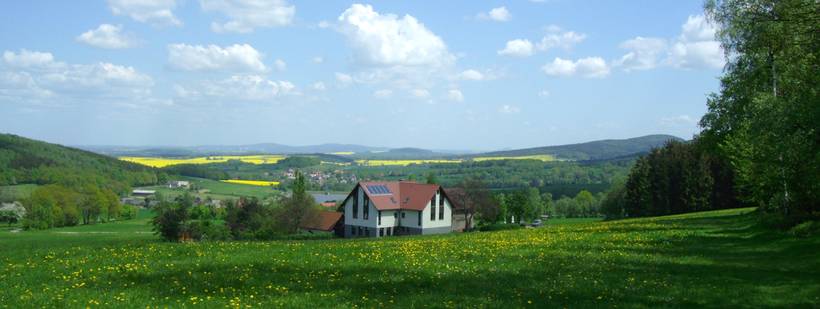
Since 1919, the inn has been family-owned. Karl Schramm, the father of the current innkeeper, owned it, and his wife Frieda (1920-2011) served and waited on tables. We often took a break there as children during our hikes (see the article "To Czorneboh").
We could also take the return route via Mehlteuer (yellow line) and turn left into the forest there. When we come out of it again, we take the green line to the right and stay on this for about 600 m. We then find ourselves on the memorial path, which leads us straight back to Ebendörfel, while the green line branches off to the right towards Binnewitz.
Total distance/route: 8.5 km
Photos: Dietmar Eichhorn
On Heimatbild.de Ebendörfel - Rote Schenke
Iets opgevallen op deze route?Probleem toevoegen
Navigeer de route met...
![]() RouteYou app Open
RouteYou app Open
Deze advertentie niet meer zien?
→ Upgrade nu
![]()
Even geduld, de navigatie wordt voorbereid.
Je kan nu navigeren. Veel plezier onderweg!
Het verwerken van de aanvraag is mislukt. Gelieve het opnieuw te proberen.
Deze advertentie niet meer zien?
→ Upgrade nu
![]()
Even geduld, je download wordt voorbereid.
Je download is klaar. Veel plezier onderweg!
Het verwerken van de aanvraag is mislukt. Gelieve het opnieuw te proberen.
Deze advertentie niet meer zien?
→ Upgrade nu
![]()
Even geduld, je afdruk wordt voorbereid.
Je afdruk is klaar om te downloaden. Veel plezier onderweg!
Het verwerken van de aanvraag is mislukt. Gelieve het opnieuw te proberen.
<iframe src="https://plugin.routeyou.com/routeviewer/free/?language=nl&params.route.id=9029878&params.language=en" width="100%" height="600" frameborder="0" allowfullscreen></iframe>
<p><a class="routeYou_embed" href="https://app.routeyou.com/en-de/route/view/9029878?utm_source=embed&utm_medium=article&utm_campaign=routeshare&navigation=external" title="Ebendörfel - Drohmberg - Rote Schenke - RouteYou" target="_blank"><img src="https://image.routeyou.com/embed/route/960x670/9029878-en@2x.png" style="width: 100%; height: auto;" alt="Ebendörfel - Drohmberg - Rote Schenke"></a></p>
Bijkomende feedback:
Deze functionaliteit is exclusief beschikbaar voor RouteYou PREMIUM-abonnees.
Probeer nu 1 maand gratis en ontdek het verschil! We vragen geen betaalgegevens en het stopt automatisch na je proefperiode van een maand.
© 2006-2025 RouteYou - www.routeyou.com


