

The Bever is known as the "diligent river" in the Münsterland. Unlike most other rivers in this region, it carries a large volume of water with a steep gradient. From its source to its mouth, it drops by 25 meters. In East Bevern alone, the river drops by 4.5 meters. This gives it a sufficiently high potential energy. Since ancient times, mills have been operated on the Bever; there were disputes over water rights, dam height, and dam times. The water rights were mostly held by monasteries or noble estates. Until the 1950s, the Bever was dammed during the autumn months, which resulted in the entire Beverwiesen being flooded to have enough water for the operation of the mills over the winter. In the 1960s, these water rights were bought up by the maintenance associations, and the mill and dam operations were discontinued. Today, there are no mills operating on the Bever anymore.
Bron: Wikipedia
 | | Publiek | Deens • Duits • Frans • Italiaans • Nederlands • Spaans
Adres: Beverstrang 40 Glandorf, 48231 Warendorf, Nordrhein-Westfalen, Duitsland
Statistieken
Selecteer hieronder één van de populairste activiteiten of verfijn je zoekopdracht.
Ontdek de mooiste en meest populaire routes in de buurt, zorgvuldig gebundeld in passende selecties.
Selecteer hieronder één van de populairste categorieën of laat je inspireren door onze selecties.
Ontdek de mooiste en meest populaire bezienswaardigheden in de buurt, zorgvuldig gebundeld in passende selecties.
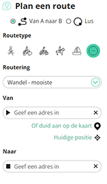
Met RouteYou kan je eenvoudig zelf aangepaste kaarten maken. Stippel je route uit, voeg waypoints of knooppunten toe, plan bezienswaardigheden en eet- en drinkgelegenheden in en deel alles met je familie en vrienden.
Routeplanner
<iframe src="https://plugin.routeyou.com/poiviewer/free/?language=nl&params.poi.id=8188888&params.language=en" width="100%" height="600" frameborder="0" allowfullscreen></iframe>

Meer dan 11.800.000 routes

Meer dan 15.000.000 gebruikers

Meer dan 4.500.000 trekpleisters

Kerkstraat 108
9050 Gentbrugge, België
© 2006-2026 RouteYou - www.routeyou.com



