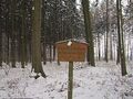
The Stemweder Berg is located in the southeast of the Dümmer Nature Park. With its 181 meters above sea level, it is the last elevation before the North German Lowlands. To the south, it is followed by the park-like cultural landscape of the municipality of Stemwede. To the east of the Dümmer is the Oppenweher Moor. The Stemweder Berg is made up of limestone from the younger Cretaceous period. This soft limestone contains imprints of shells, as well as whole shells. Various fossils are exhibited in the Dümmer Museum in Lembruch. The forest consists mainly of beech trees. Here, there are two large stands of the extremely rare primeval beech forest. In the Stemweder Berg, various historical boundary stones can be discovered. Due to the Peace of Westphalia in 1648, Minden and thus the area south of the Stemweder Berg came under Brandenburg (Prussia). High-stemmed orchards provide habitat for the dormouse, little owl, and various bat species. Water quickly disappears again in the glacial dry valleys of the Stemweder Berg. Only small shallow ponds exist sporadically. In addition to native wildlife such as deer, hare, pheasant, and fox, you can find the woodpecker and black woodpecker. Also represented are the primrose, arum, lily of the valley, native orchids, and sweet woodruff. This extensive forest area is accessible via well-developed and marked hiking trails of various lengths, each starting at a hiking parking lot. The overview panels and the hiking map provide information and help with orientation. All routes are also suitable for walking or jogging.
Iets opgevallen op deze route?Probleem toevoegen
Navigeer de route met...
![]() RouteYou app Open
RouteYou app Open
Deze advertentie niet meer zien?
→ Upgrade nu
![]()
Even geduld, de navigatie wordt voorbereid.
Je kan nu navigeren. Veel plezier onderweg!
Het verwerken van de aanvraag is mislukt. Gelieve het opnieuw te proberen.
Deze advertentie niet meer zien?
→ Upgrade nu
![]()
Even geduld, je download wordt voorbereid.
Je download is klaar. Veel plezier onderweg!
Het verwerken van de aanvraag is mislukt. Gelieve het opnieuw te proberen.
Deze advertentie niet meer zien?
→ Upgrade nu
![]()
Even geduld, je afdruk wordt voorbereid.
Je afdruk is klaar om te downloaden. Veel plezier onderweg!
Het verwerken van de aanvraag is mislukt. Gelieve het opnieuw te proberen.
<iframe src="https://plugin.routeyou.com/routeviewer/free/?language=nl&params.route.id=14120537&params.language=en" width="100%" height="600" frameborder="0" allowfullscreen></iframe>
<p><a class="routeYou_embed" href="https://app.routeyou.com/en-de/route/view/14120537?utm_source=embed&utm_medium=article&utm_campaign=routeshare&navigation=external" title="Stemweder Mountain Circular Hiking Trail Yellow-dotted - RouteYou" target="_blank"><img src="https://image.routeyou.com/embed/route/960x670/14120537-en@2x.png" style="width: 100%; height: auto;" alt="Stemweder Mountain Circular Hiking Trail Yellow-dotted"></a></p>
Bijkomende feedback:
Deze functionaliteit is exclusief beschikbaar voor RouteYou PREMIUM-abonnees.
Probeer nu 1 maand gratis en ontdek het verschil! We vragen geen betaalgegevens en het stopt automatisch na je proefperiode van een maand.
© 2006-2026 RouteYou - www.routeyou.com