

The Cathays electoral ward of Cardiff, created in 1890, which since 1974 has covered the Cathays and Castle communities. There is no community council for the area and it has elected three Cardiff councillors from the outset.
The Cathays ward includes some or all of the following areas: Blackweir, Cardiff city centre, Cathays Park and Maindy in the parliamentary constituency of Cardiff Central. It is bounded by Gabalfa and Birchgrove to the north; Plasnewydd and Adamsdown to the east; Butetown to the south; and Riverside to the west. The River Taff forms its western boundary to where it meets the South Wales Main Line, the South Wales Main Line forms the southern boundary to where it meets the Valley Lines northbound branch, this railway line then forms the eastern boundary as far as the A48 road. The Northern boundary follows the A48 as far as Allensbank Road where it follows this road south then turns north again along Whitchurch Road. It turns west along Crown Way, then south along the A470 until North Road where it bears west, passing just south of the student halls, until it meets the River Taff. The tallest building in Wales is here and is also part of the Cardiff's CBD.
Bron: Wikipedia.org
Auteursrechten: Creative Commons 3.0
 | | Publiek
Adres: Cathays, Cardiff, Verenigd Koninkrijk
Statistieken
Selecteer hieronder één van de populairste activiteiten of verfijn je zoekopdracht.
Ontdek de mooiste en meest populaire routes in de buurt, zorgvuldig gebundeld in passende selecties.
Bron: Sionk
Auteursrechten: Creative Commons CC BY-SA 4.0
Selecteer hieronder één van de populairste categorieën of laat je inspireren door onze selecties.
Ontdek de mooiste en meest populaire bezienswaardigheden in de buurt, zorgvuldig gebundeld in passende selecties.
Bron: Sionk
Auteursrechten: Creative Commons CC BY-SA 4.0
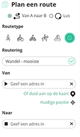
Met RouteYou kan je eenvoudig zelf aangepaste kaarten maken. Stippel je route uit, voeg waypoints of knooppunten toe, plan bezienswaardigheden en eet- en drinkgelegenheden in en deel alles met je familie en vrienden.
Routeplanner
<iframe src="https://plugin.routeyou.com/poiviewer/free/?language=nl&params.poi.id=1522108&params.language=en" width="100%" height="600" frameborder="0" allowfullscreen></iframe>

Meer dan 11.800.000 routes

Meer dan 15.000.000 gebruikers

Meer dan 4.500.000 trekpleisters

Kerkstraat 108
9050 Gentbrugge, België
© 2006-2026 RouteYou - www.routeyou.com



