The Forest of Bowland, also known as the Bowland Fells, is an area of barren gritstone fells, deep valleys and peat moorland, mostly in north-east Lancashire, England with a small part in North Yorkshire (before 1974, some of the area was in the West Riding of Yorkshire). It is a western spur of the Pennines[1] and was once described as the "Switzerland of England".[2][3]
The Forest of Bowland has been designated an Area of Outstanding Natural Beauty (AONB) since 1964. The Forest of Bowland AONB also includes a detached part known as the Forest of Pendle separated from the main part by the Ribble Valley, and anciently a forest with its own separate history. One of the best-known features of the area is Pendle Hill, which lies in Pendle Forest. There are more than 500 listed buildings and 18 scheduled monuments within the AONB.
Bowland survives as the north-western remainder of the ancient wilderness that once stretched over a huge part of England, encompassing the Forest of Bowland, Sherwood Forest (Nottinghamshire), the New Forest (Hampshire) and Savernake Forest (Wiltshire). While the Trough of Bowland (the valley and high pass connecting the Wyre (at Marshaw) and Langden Brook and dividing the upland core of Bowland into two main blocks) represents the area, to many, on account of its popularity, it is in fact only a small part of the wider Forest of Bowland area.
The hills on the western side of the Forest of Bowland attract walkers from Lancaster and the surrounding area. Overlooking Lancaster is Clougha Pike, the western-most hill. The hills form a large horseshoe shape with its open end facing west. Clockwise from Lancaster the hills are Clougha Pike (413 m or 1,355 ft), Grit Fell (468 m or 1,535 ft), Ward's Stone (561 m or 1,841 ft), Wolfhole Crag (527 m or 1,729 ft), White Hill (544 m or 1,785 ft), Whins Brow (476 m or 1,562 ft), Totridge (496 m or 1,627 ft), Parlick (432 m or 1,417 ft), Fair Snape Fell (510 m or 1,670 ft), Bleasdale Moor (429 m or 1,407 ft), and Hawthornthwaite Fell (478 m or 1,568 ft). Considerable areas of the Bowland fells were used for military training during the Second World War, and there are still unexploded bombs in some areas.
The area contains the geographic centre of Great Britain which is close to the Whitendale Hanging Stones, around four miles (6 km) north of Dunsop Bridge. The historical extent of Bowland Forest is divided into two large administrative townships, Great Bowland (Bowland Forest High and Bowland Forest Low) and Little Bowland (Bowland-with-Leagram), but the modern-day AONB covers a much larger area.
Bron: Wikipedia
 | | Publiek | Nederlands

Selecteer hieronder één van de populairste activiteiten of verfijn je zoekopdracht.
Ontdek de mooiste en meest populaire routes in de buurt, zorgvuldig gebundeld in passende selecties.
Bron: Eryka Hurst
Auteursrechten: Creative Commons CC BY-SA 2.0
Selecteer hieronder één van de populairste categorieën of laat je inspireren door onze selecties.
Ontdek de mooiste en meest populaire bezienswaardigheden in de buurt, zorgvuldig gebundeld in passende selecties.
Bron: Eryka Hurst
Auteursrechten: Creative Commons CC BY-SA 2.0
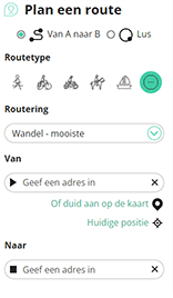
Met RouteYou kan je eenvoudig zelf aangepaste kaarten maken. Stippel je route uit, voeg waypoints of knooppunten toe, plan bezienswaardigheden en eet- en drinkgelegenheden in en deel alles met je familie en vrienden.
Routeplanner
<iframe src="https://plugin.routeyou.com/poiviewer/free/?language=nl&params.poi.id=7297467&params.language=en" width="100%" height="600" frameborder="0" allowfullscreen></iframe>

Meer dan 11.800.000 routes

Meer dan 15.000.000 gebruikers

Meer dan 4.500.000 trekpleisters

Kerkstraat 108
9050 Gentbrugge, België
© 2006-2026 RouteYou - www.routeyou.com



